Category:Maps showing the history of languages
Jump to navigation
Jump to search
Media in category "Maps showing the history of languages"
The following 30 files are in this category, out of 30 total.
-
 Ausztria-Magyarország nemzetiségei.svg 1,360 × 1,052; 3.38 MB
-
 Balkan map 1910 Adolf Marx.jpg 6,400 × 4,800; 4.11 MB
-
 Balkans 200AD.png 436 × 313; 300 KB
-
 Brockhaus 1894 Deutsche Mundarten Sorbisch.jpg 900 × 675; 464 KB
-
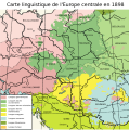 Carte linguistique - Europe centrale - 1898.svg 1,039 × 1,046; 1.4 MB
-
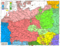
 Central Europe (ethnic).JPG 2,230 × 1,436; 2.81 MB
-
 Czechoslovakia 1930 linguistic map - de.svg 1,281 × 778; 740 KB
-
 East European population and languages - Russian map of 1907.jpg 900 × 874; 371 KB
-
 Finno-ugrian-map-de.svg 963 × 987; 927 KB
-
 Finno-ugrian-map-ukr.svg 963 × 987; 927 KB
-
 Finno-ugrian-map.svg 963 × 987; 927 KB
-
 Finnugroj en 1000 (eo).svg 963 × 987; 927 KB
-
 Geographic Distribution of some Ancient Semitic Inscriptions and their Languages.svg 2,100 × 2,300; 744 KB
-
 Germanic Groups ca. 0CE.jpg 756 × 600; 183 KB
-
 Historical German linguistical area.PNG 1,031 × 651; 63 KB
-
 London-geographical-institute the-peoples-atlas 1920 europe-racial-and-linguistic.jpg 3,992 × 3,012; 2.05 MB
-
 Map Romanian Dawns.jpg 2,607 × 2,434; 2.77 MB
-
 Muromian-map.png 610 × 622; 165 KB
-
 Old norse, ca 900.PNG 1,235 × 909; 100 KB
-
 Polish language1880.png 788 × 746; 131 KB
-
 Roman provincial languages 150CE.png 1,280 × 882; 319 KB
-
 Samoyedic map XVII-XX.png 450 × 500; 36 KB
-
 Sprachenkarte Deutschland1880.png 1,513 × 1,166; 356 KB
-
 Sprachenkarte Kozenn 1906.jpg 1,528 × 1,550; 2.06 MB
-
 The story of a word.jpg 2,677 × 1,991; 1.83 MB
-
 ThracianLanguageMap.jpg 1,008 × 518; 156 KB
-
 Tschechen1880 mit Schönhengstgau.jpg 886 × 589; 874 KB
-
 Tschechen1880.gif 886 × 589; 185 KB
-
 Urheimat ipotesi.png 1,250 × 720; 1.42 MB
-
 Мовна мапа на 1915 рік.png 555 × 717; 509 KB


.JPG)


.svg)


