Category:Maps showing the 440s
Jump to navigation
Jump to search
Media in category "Maps showing the 440s"
This category contains only the following file.
-
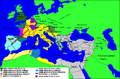 Impero d'Occidente 445.PNG 900 × 595; 124 KB
| Splitting of this category has been suggested. See Commons:Categories for discussion/2014/01/Category:Maps by year. |
| Maps showing the 5th century: |
This category contains only the following file.
