Category:Maps showing 6th-century BC history
Jump to navigation
Jump to search
| Preceded by: 7th century BC maps |
6th century BC maps 600 BC-501 BC |
Succeeded by: 5th century BC maps |
Subcategories
This category has the following 3 subcategories, out of 3 total.
A
- Anaximander's world map (46 F)
H
Media in category "Maps showing 6th-century BC history"
The following 47 files are in this category, out of 47 total.
-
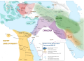
 Alter Orient 0600BC.svg 2,102 × 1,510; 4.95 MB
-
 Alter Orient+Persien 600BC.svg 3,100 × 1,960; 7.38 MB
-
 Ancient India - ta.png 800 × 655; 71 KB
-
 Ancient india-zh.png 800 × 655; 82 KB
-
 Ancient india.png 800 × 655; 36 KB
-
 Atlas Universel d'Histoire et de Géographie - Carte 7.jpg 1,579 × 1,280; 387 KB
-
 Battles of Ancient Greece 700-168 BC (English).svg 993 × 793; 3.25 MB
-
 Battles of Ancient Greece 700-168 BC (Portuguese).svg 993 × 793; 3.25 MB
-
 Brockhaus' Konversations-Lexikon (1892) (14778047681).jpg 2,480 × 1,612; 905 KB
-
 Carte-Empire néo-assyrien.png 931 × 800; 233 KB
-
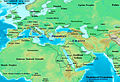
 East-Hem 600bc.jpg 3,240 × 1,903; 731 KB
-
 Halys 1 layer.svg 1,207 × 978; 515 KB
-
 Herodotus's world (Central Asia).png 567 × 425; 464 KB
-
 Iron Age Italy-id.svg 432 × 525; 271 KB
-
 Iron Age Italy-ru.svg 432 × 525; 215 KB
-
 Iron Age Italy.svg 432 × 525; 271 KB
-
 Map of Lydia ancient times-en.svg 400 × 277; 47 KB
-
 Map of Lydia ancient times-eo.svg 400 × 277; 47 KB
-
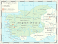 Map of the Kingdom of Lydia.png 2,456 × 1,871; 961 KB
-
 Map of the middle east in 650 BC.png 1,149 × 525; 47 KB
-
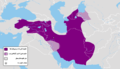 Median Empire-The first half of the 6th century BC.png 1,619 × 925; 214 KB
-
 Median Empire.jpg 1,306 × 735; 187 KB
-
 Median Empire.svg 1,249 × 693; 231 KB
-
 Median Empire2-es.svg 1,129 × 588; 876 KB
-
 NE 323bc.jpg 1,466 × 1,007; 446 KB
-
 Near East 600BC.svg 2,102 × 1,510; 4.93 MB
-
 Oriente Medio 600 adC (vacío).svg 1,249 × 693; 231 KB
-
 Oriente Medio 600 adC(puntos).svg 1,249 × 693; 253 KB
-
 Oriente Medio 600 adC-pt.svg 1,249 × 693; 234 KB
-
 Oriente Medio 600 adC.svg 1,249 × 693; 234 KB
-
 Osi India.png 3,334 × 2,730; 213 KB
-
 Rothert, Bd1Bl01K2 - Das Morgenland um 600 v. Chr.jpg 2,570 × 2,156; 800 KB
-
 Rothert, Bd1Bl04K1 - Entwicklung der spartanischen Führung und Anfänge Athens.jpg 2,866 × 2,737; 1.24 MB
-
 Shepherd-c-012.jpg 1,542 × 966; 366 KB
-
 Siège de Porsenna.GIF 1,060 × 588; 32 KB
-
 Spraak jernalder italia.png 1,807 × 2,193; 494 KB
-
 The Achaemenid Empire in 550 bc.png 1,132 × 585; 47 KB
-
 West Mediterranean Areas 509 BC.png 1,340 × 937; 2.07 MB
-
 West Mediterranean navigation limit 509 BC.png 1,340 × 937; 2.16 MB
-
 West Mediterranean navigation limit 509 BC.svg 981 × 723; 374 KB
-
 West Mediterranean sea areas of influence 509 BC.png 1,200 × 800; 584 KB
-
 West Mediterranean sea areas of influence 509BC-es.svg 812 × 408; 1.14 MB
-
 West Mediterranean sea areas of influence 509BC-fr (2).svg 981 × 723; 435 KB
-
 West Mediterranean sea areas of influence 509BC-fr.svg 812 × 408; 1.12 MB
-
 West Mediterranean sea areas of influence 509BC-it.svg 812 × 408; 1.14 MB
-
 World in 500 BCE.png 4,000 × 1,986; 974 KB
-
 World peopleing 2.jpg 712 × 522; 122 KB


.svg)
.svg)
_(14778047681).jpg)


.png)


.svg)
.svg)


.svg)


