Category:Maps showing 15th-century history
Jump to navigation
Jump to search
| Preceded by: 14th century maps |
15th century maps 1401 AD-1500 AD |
Succeeded by: 16th century maps |
Subcategories
This category has the following 20 subcategories, out of 20 total.
Media in category "Maps showing 15th-century history"
The following 102 files are in this category, out of 102 total.
-
 The Milanese under the Visconti.jpg 789 × 763; 372 KB
-
 1422 Zeta in the Serbian Despotate after death Balsa III.svg 994 × 1,834; 111 KB
-
 Gelre1477.png 772 × 673; 937 KB
-
 16th century Spanish expansion in the Caribbean.png 1,030 × 552; 361 KB
-
-

-
 A világ 1402-ben.png 2,832 × 1,402; 1.52 MB
-
 Ak Qoyunlu Turcomans 1468–1501.png 620 × 429; 34 KB
-
 Armanhac sXV.jpg 1,280 × 690; 446 KB
-
 Aztecexpansion-es.svg 2,066 × 1,095; 354 KB
-
 Aztecexpansion-pt.svg 2,066 × 1,095; 348 KB
-
 Bahamani-sultanate-map.svg 1,521 × 1,761; 334 KB
-
 Bernat I de Vilamarí en Castellroig 01.jpg 1,181 × 1,118; 218 KB
-
 Bernat I de Vilamarí in Kastelorizo 01.jpg 1,062 × 1,006; 188 KB
-
 Brunei Empire Extent 15th century.svg 1,000 × 500; 1,005 KB
-
 Brunei territories (1400).jpg 1,920 × 960; 398 KB
-
 Carte Lorraine 15eme.png 954 × 888; 287 KB
-
 Chupanid - Jalayerid dyansty 1337–1432 ad-ar.png 620 × 428; 37 KB
-
 Chupanid - Jalayerid dyansty 1337–1432 ad.PNG 620 × 428; 23 KB
-
 Conquests of Carlo I Tocco-es.svg 2,098 × 1,694; 937 KB
-
 Conquests of Carlo I Tocco.svg 2,098 × 1,694; 826 KB
-
 County of Rodez 01.jpg 715 × 726; 134 KB
-
 CrimeeXV-s.jpg 394 × 311; 147 KB
-
 Crusade of Varna map.png 1,930 × 966; 399 KB
-
 DesmembramientoDelIljanato1337–1432(v2)-pt.svg 982 × 685; 260 KB
-
 DesmembramientoDelIljanato1337–1432.svg 1,801 × 1,373; 2.13 MB
-
 Dutch Urban Centers in Holland.png 302 × 337; 60 KB
-
 Découvertes sous Henri Le Navigateur.JPG 460 × 372; 34 KB
-
 Etat bourguignon Philippe le Bon Fr.png 1,213 × 1,802; 837 KB
-
 Expansion Imperio Inca-1-.JPG 300 × 555; 85 KB
-
 Extension of Ennarea in around 1500.png 850 × 930; 47 KB
-
 Lageplan der Pillenreuther Weiher.jpg 642 × 715; 179 KB
-
 Giurisdizioni bresciane in epoca veneta (Luca Giarelli).png 1,367 × 2,000; 273 KB
-
 Grand Duchy of Lithuania Rus and Samogitia 1434.jpg 767 × 952; 433 KB
-
 Grandesdécouvertes.png 420 × 300; 85 KB
-
 Habsburg mortgages between 15th and 17th centuries.jpg 863 × 410; 188 KB
-
 Habsburg mortgages in Hungary between 15th and 17th centuries.jpg 1,417 × 1,006; 801 KB
-
 Hermandad de las Cuatro Villas.svg 938 × 1,119; 534 KB
-
 History of Russia, IX-XV c.jpg 2,538 × 3,277; 1.4 MB
-
 Hungarian post-Matthias succession wars (1490-94).jpg 1,700 × 1,474; 487 KB
-
 Imperi de la Corona d'Aragó.png 386 × 255; 4 KB
-
 ImperioOtomanoSimplificado-ar.svg 912 × 750; 901 KB
-
 ImperioOtomanoSimplificado-pt.svg 912 × 750; 753 KB
-
 ImperioOtomanoSimplificado.svg 912 × 750; 2.27 MB
-
 Implantation des Bournonville en Boulonnais (v.1350-v.1500).svg 745 × 1,095; 98 KB
-
 Inca-expansion.png 1,730 × 3,200; 78 KB
-
 Italia 1494-ua.svg 1,701 × 2,002; 1.01 MB
-
 Italy 1494 cn.svg 512 × 613; 732 KB
-
 Italy 1494 de.svg 941 × 1,059; 755 KB
-
 Italy 1494-fr.svg 3,634 × 4,308; 733 KB
-
 Italy 1494.svg 3,481 × 4,167; 1.18 MB
-
 Jagiellon Realm.png 587 × 511; 13 KB
-
 Johan van Selbach *1483 map Crottorf and Drenthe.jpg 440 × 520; 140 KB
-
 Karte Archidiaconate und Decanate des Bischtums Constanz.jpg 4,212 × 4,377; 5.69 MB
-
 Kingdom of England.png 1,218 × 1,245; 20 KB
-
 Kobrynske knjazivstvo.png 702 × 597; 150 KB
-
 La France en 1477, à la mort de Charles le Téméraire.jpg 3,750 × 4,078; 4.5 MB
-
 Location of the Kingdom of the Two Sicilies-it mod.PNG 500 × 600; 102 KB
-
 Location of the Kingdom of the Two Sicilies-it.svg 3,500 × 4,200; 1.07 MB
-
 Location of the Kingdom of the Two Sicilies-no.svg 3,500 × 4,200; 1.07 MB
-
 LocationKingdomOfAragon.png 779 × 563; 16 KB
-
 LocationKingdomOfCastile.png 779 × 563; 17 KB
-
 Map France 1477-br.svg 900 × 970; 1,021 KB
-
 Map of Italy (1402)-fr.png 3,321 × 3,837; 1.17 MB
-
 Map of the southern Balkans, 1410-es.svg 2,217 × 1,959; 2.76 MB
-
 Map of the southern Balkans, 1410.svg 2,217 × 1,959; 2.56 MB
-
 Mappa dello Stato dei Cavalieri Teutonici 1410.jpg 1,654 × 1,449; 1.65 MB
-
 MongolEmpire hu.svg 700 × 366; 132 KB
-
 MongolEmpire.jpg 700 × 366; 44 KB
-
 Nevilles of Brancepeth and Raby.png 572 × 552; 205 KB
-
 Campañas mediterráneas de Pero Niño 01.png 1,200 × 773; 190 KB
-
 Campañas mediterráneas de Pero Niño 02.png 1,200 × 729; 277 KB
-
 Campañas mediterráneas de Pero Niño 03.png 1,200 × 1,001; 81 KB
-
 Ostfranken um 1400.png 861 × 796; 399 KB
-
 Plan de la bataille de Nancy.png 1,546 × 1,708; 130 KB
-
 Portuguese discoveries and explorationsV2en.png 1,357 × 628; 213 KB
-
 Princedom of simsim.jpg 903 × 591; 277 KB
-
 Prodor turaka u crnu goru XV c BC b.png 839 × 1,223; 245 KB
-
 Province napoletane (1454).PNG 1,679 × 1,460; 158 KB
-
 Saxony (Division of Leipzig) - DE.png 1,430 × 959; 653 KB
-
 Saxony (Division of Leipzig) - NL.png 2,875 × 1,933; 1.44 MB
-
 Se Easterna Wendelsæ in 1450.svg 2,529 × 2,395; 278 KB
-
 Seigneurie de Carpi, détail.png 923 × 878; 243 KB
-
 Seigneurie de Carpi.png 1,393 × 1,078; 306 KB
-
 Senyera Macià Viladestes 1423.jpg 2,448 × 3,264; 3.62 MB
-
 Tannenberg 1410.png 1,200 × 1,424; 855 KB
-
 TerrGeldKle2 16Jhdt.jpg 503 × 684; 139 KB
-
 Teutonic Order 1410-es.svg 1,210 × 1,053; 1.69 MB
-

-
 The wars of Matthias Corvinus of Hungary (1458-1490).png 1,700 × 1,707; 637 KB
-

-
 Traité de Troyes-ar.png 425 × 519; 124 KB
-
 Treaty of Troyes-ja.svg 425 × 519; 37 KB
-
 Tupac-inca-conquest.png 1,730 × 3,200; 67 KB
-
 Venetian property, and invasion of the Serbian Despotate (Djuradj Brankovic).svg 1,222 × 1,243; 40 KB
-
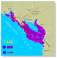
 Venetian seaside properties in Montenegro 1448.png 1,020 × 1,024; 240 KB
-
 Venetian seside properties in Montenegro 1448-es.svg 1,156 × 1,170; 524 KB
-
 Vexilographic maps of Pontic littoral by end of 13th-17th century.svg 1,640 × 895; 2.58 MB
-
 Zayyanid dynasty map.png 830 × 482; 9 KB
-
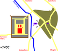 ZielGora-1400.png 1,684 × 1,488; 60 KB
-
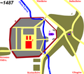 ZielGora-1487.png 1,684 × 1,488; 70 KB
-
 Священная Римская Империя-1400.jpg 2,079 × 1,919; 2.31 MB


_-_Geographicus_-_AsiaXVXVI-spruneri-1855.jpg)
)%27_(11155553203).jpg)


.jpg)


-pt.svg)


.png)


.jpg)


.svg)


-fr.png)


.PNG)
_-_DE.png)
_-_NL.png)


_(14596835738).jpg)
.png)


.svg)


