Category:Maps showing 1360
Jump to navigation
Jump to search
| 1360 → |
English: Maps showing the year 1360 (i.e. history maps)
See also category: 1360 maps. and 1360s maps for old maps created in this time.
See also category: 1360 maps. and 1360s maps for old maps created in this time.
Media in category "Maps showing 1360"
The following 8 files are in this category, out of 8 total.
-
 Angevin Europe 1360.jpg 649 × 498; 170 KB
-
 Byz Empire Osman Trebizond 1360.png 552 × 392; 93 KB
-
 CastillaLeon 1360-es.svg 1,696 × 1,426; 913 KB
-
 CastillaLeon 1360-fr.svg 1,927 × 1,426; 406 KB
-
 CastillaLeon 1360-pt.svg 1,696 × 1,426; 1.04 MB
-
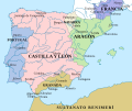
 CastillaLeon 1360.png 614 × 552; 702 KB
-
 English Possessions in France, 1180-1429.png 563 × 877; 1.28 MB
-
 МК1360.jpg 672 × 462; 86 KB


