Category:Maps relating to the 2008-2009 Gaza War
Jump to navigation
Jump to search
Subcategories
This category has only the following subcategory.
Media in category "Maps relating to the 2008-2009 Gaza War"
The following 9 files are in this category, out of 9 total.
-
 Emergency aid to Gaza in 2009.PNG 1,425 × 625; 49 KB
-
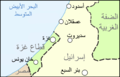 Gaza 2008 conflict map Arabic.png 1,364 × 875; 247 KB
-
 Gaza conflict map Rockets.png 1,365 × 878; 398 KB
-
 Gaza Strip 2009 Jan 13.png 1,062 × 1,504; 369 KB
-
 Gazastreifen Raketenreichweiten.png 1,200 × 2,019; 546 KB
-
 Rokets from Gaza rus.png 867 × 1,200; 258 KB
-
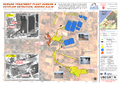 UNOSAT Gaza Sewage Plant Pre Post Map v12 Highres.png 3,306 × 2,340; 7.23 MB
-
 UNOSAT Gaza WV Damage Overview 10Jan09 Highres v2.page1.png 1,587 × 1,123; 2.37 MB
-
 UNOSAT GazaStrip Damage Review 19Feb09 v3 Lowres.png 2,481 × 3,509; 4.54 MB


