Category:Maps related to Mormonism
Jump to navigation
Jump to search
Subcategories
This category has the following 2 subcategories, out of 2 total.
D
M
Media in category "Maps related to Mormonism"
The following 45 files are in this category, out of 45 total.
-
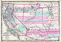
 1846 Mitchell's Map of Texas Oregon and California - Geographicus - TXORCA-mitchell-1846.jpg 5,000 × 5,420; 5.64 MB
-

-

-

-

-
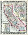 1860 Mitchell's Map of California - Geographicus - CA-m-1860.jpg 3,302 × 4,131; 3.69 MB
-
-
 A Choice Land Wikipedia.jpg 557 × 563; 190 KB
-
 Battalionmap.png 1,000 × 643; 90 KB
-
 Battle of Crooked River-es.png 564 × 452; 280 KB
-
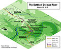 Battle of Crooked River.jpg 564 × 452; 106 KB
-
 Between the Mississippi and Missouri BHoU-p222.png 4,448 × 1,394; 95 KB
-
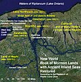
 Book of Mormon Lands and Sites2.jpg 1,280 × 1,024; 1,004 KB
-
 Bountiful.locations.300px.png 300 × 214; 42 KB
-
 Bountiful.locations.png 497 × 355; 96 KB
-
 BRM3458-Weston-Map-of-Ancient-America Mormon-1899 lowres-1888x3000.jpg 1,888 × 3,000; 1.04 MB
-
 Burned over district.svg 1,572 × 1,277; 613 KB
-

-
 LDS expansion western north america-es.svg 1,170 × 1,231; 61 KB
-
 LDS expansion western north america.svg 1,170 × 1,231; 62 KB
-
 LDS1830-1839.svg 886 × 656; 107 KB
-
 LDS1846-1869 it.svg 882 × 525; 73 KB
-
 LDS1846-1869-es.svg 882 × 525; 72 KB
-
 LDS1846-1869.svg 882 × 525; 73 KB
-
 MalayMap.jpg 609 × 846; 90 KB
-
 Map of USA highlighting Jello Belt.png 280 × 183; 37 KB
-
 Mormon Trail 3.png 1,040 × 728; 617 KB
-
 MormonWarMap english.svg 500 × 520; 928 KB
-
 MormonWarMap spanish.svg 500 × 520; 928 KB
-
 MormonWarMap1.jpg 448 × 430; 108 KB
-
 Route of the Mormon pioneers from Nauvoo to Great Salt Lake.jpg 1,536 × 524; 141 KB
-
 Salt Lake City in 1860 BHoU-p580.png 3,949 × 3,056; 240 KB
-
 Settlements in Illinois BHoU-p136.png 3,655 × 3,178; 223 KB
-
 Site of Gunnison Massacre BHoU-p469.png 2,952 × 1,982; 137 KB
-

-
 State of Deseret, vector image - 2011.svg 371 × 398; 19 KB
-
 State of Deseret, vector image cropped - 2011.svg 320 × 310; 29 KB
-
 Temple Square.svg 1,200 × 750; 10 KB
-
 Utah Settlements 1852 BHoU-p306.png 2,914 × 3,430; 256 KB
-
 Utah Territory with Deseret Border, vector image - 2011.svg 320 × 310; 29 KB
-
 War in Missouri BHoU-p121.png 2,942 × 3,522; 214 KB
-
 Western Trails in Nebraska.svg 7,414 × 3,411; 85 KB
-
 Wpdms deseret utah territory legend.png 300 × 360; 67 KB
-
 Zionplat2 (cropped to grid).jpg 459 × 478; 235 KB
-
 Zionplat2.jpg 650 × 851; 536 KB

_-_Geographicus_-_LevenworthGreatSaltLake2-stansbury-1852.jpg)


_-_Geographicus_-_LevenworthGreatSaltLake-stansbury-1852.jpg)


.jpg)
