Category:Maps of weather and climate of China
Jump to navigation
Jump to search
Countries of Asia: Afghanistan · Armenia‡ · Azerbaijan‡ · Bangladesh · Bhutan · Cambodia · People's Republic of China · Cyprus‡ · East Timor · Egypt‡ · Georgia‡ · India · Indonesia‡ · Iran · Iraq · Israel · Japan · Jordan · Kazakhstan‡ · Kuwait · Kyrgyzstan · Laos · Lebanon · Malaysia · Mongolia · Myanmar · Nepal · North Korea · Oman · Pakistan · Philippines · Qatar · Russia‡ · Saudi Arabia · South Korea · Sri Lanka · Syria · Tajikistan · Thailand · Turkey‡ · Turkmenistan · United Arab Emirates · Uzbekistan · Vietnam · Yemen
Limited recognition: Taiwan · State of Palestine
‡: partly located in Asia
Limited recognition: Taiwan · State of Palestine
‡: partly located in Asia
Subcategories
This category has the following 2 subcategories, out of 2 total.
I
- Insolation maps of China (7 F)
Media in category "Maps of weather and climate of China"
The following 16 files are in this category, out of 16 total.
-
 August 22, 1929, Hong Kong typhoon.png 511 × 383; 521 KB
-
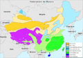
 Average annual precipitation in China(Chinese).png 900 × 794; 358 KB
-
 Average annual precipitation in China(English).png 900 × 794; 367 KB
-
 Average annual precipitation in China.png 900 × 794; 333 KB
-
 China - Clima.png 995 × 696; 267 KB
-
 China average annual precipitation (en).png 900 × 794; 270 KB
-
 China flooding - June 15, 2008.svg 857 × 699; 268 KB
-
 China Hardiness Map 1.jpg 782 × 650; 120 KB
-
 China precipitation.jpg 1,256 × 956; 115 KB
-
 China snow 2008 eng.png 713 × 600; 98 KB
-
 China snow.png 713 × 600; 96 KB
-
 Climate Map for Manchuria-Northeast China.png 800 × 726; 66 KB
-
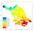 Jiangsu Province(weather).png 672 × 624; 44 KB
-
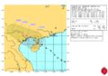 JTWC wp0914-34.gif 1,024 × 718; 136 KB
-
 Niederschlag Volksrepublik China.svg 800 × 680; 214 KB
-
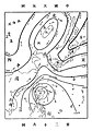 《气学通铨》中的中国天气图.jpg 277 × 397; 51 KB

.png)
.png)


.png)


