Category:Maps of voyages
Jump to navigation
Jump to search
Subcategories
This category has the following 14 subcategories, out of 14 total.
Media in category "Maps of voyages"
The following 197 files are in this category, out of 197 total.
-
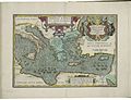
 1598 map of the Polar Regions by Willem Barentsz.jpg 13,719 × 10,160; 30.66 MB
-

-
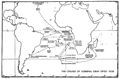
 Cowley's Circumnavigation 1699.jpg 6,387 × 3,699; 5.24 MB
-
 Muscovy1715.jpg 1,143 × 823; 841 KB
-
-
-

-

-

-
 1777 Cook Map of the Friendly Islands or Tonga - Geographicus - FriendlyIsles-cook-1777.jpg 3,000 × 1,970; 1.54 MB
-
 1780 Cook - Hogg Map of Tahiti ( Society Islands ) - Geographicus - Tahiti-hogg-1780.jpg 4,000 × 2,138; 912 KB
-
 1785 Cook - Bligh Map of Hawaii - Geographicus - Hawaii-cook-1785.jpg 4,000 × 2,435; 1.64 MB
-

-
-
-
 1798 Cassini Map of Alaska and the Bering Strait - Geographicus - Alaska-cassini-1798.jpg 4,000 × 2,897; 3.09 MB
-

-

-

-
 1801 Cary Map of the World on Mercator Projection - Geographicus - WorldMerc-cary-1801.jpg 5,000 × 4,451; 7.15 MB
-
 1814 Thomson Map of the Atlantic Ocean - Geographicus - Atlantic-t-1814.jpg 5,000 × 3,990; 2.94 MB
-

-

-
-

-

-

-
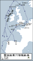
 B(1871) p008 MAP given to The Cruise round the World of the Flying Squadron 1869-1870.jpg 5,297 × 2,825; 8.54 MB
-
 (1885) p053 Map of the Cruise Paspebiac to the Magdalen Isles.jpg 877 × 681; 292 KB
-

-
 (1885) p098 Map of the Cruise from the Bay of Islands to St. Pierre.jpg 902 × 957; 474 KB
-
 (1885) p127 Map of the Cruise from St. Pierre to Georgetown.jpg 905 × 333; 140 KB
-

-

-
 A Lady's Cruise-map.png 3,357 × 1,588; 7.92 MB
-

-

-

-

-
 Aeneae exsilia.png 1,347 × 746; 130 KB
-
 Aeneae exsilia.svg 1,230 × 656; 459 KB
-
 Africa simon.jpg 341 × 341; 14 KB
-
 Airship Italia flights.svg 150 × 440; 1.41 MB
-
 Amelia Earhart flight route.svg 2,326 × 1,420; 232 KB
-
 Andree expedition-fr.png 2,222 × 1,833; 813 KB
-
 Andreeexpedition.png 2,222 × 1,833; 842 KB
-

-
 Beaufort Sea.png 470 × 418; 31 KB
-
 Belitung ship routes-pt.svg 1,096 × 674; 525 KB
-
 Belitung ship routes.svg 1,096 × 674; 525 KB
-
 Bellingshausen-es.svg 503 × 621; 4.35 MB
-
 Bellingshausen-fr.svg 503 × 621; 4.35 MB
-
 C.C.Fernberger.png 2,000 × 1,015; 202 KB
-
 TerreNeuve16e.jpg 320 × 514; 36 KB
-
 Cabral voyage 1500.svg 1,410 × 1,058; 2.21 MB
-
 Caminho maritimo para a India-picsay.png 556 × 396; 41 KB
-
 Carte de Groenland (1647) - Isaac La Peyrère - 1 full.png 8,287 × 3,623; 30.42 MB
-
 Cavindasch.png 1,425 × 625; 48 KB
-
 Charles Darwins Weldumsegelung new.svg 1,750 × 1,000; 1.61 MB
-
 Charles Darwins Weldumsegelung new2.svg 1,750 × 950; 1.39 MB
-
 Charles wilkes part1.png 2,570 × 1,070; 127 KB
-
 Charles Wilkes part2.png 2,394 × 983; 122 KB
-
 Charles Wilkes-fr.svg 353 × 431; 4.5 MB
-
 Circumnavigation marchand.svg 1,266 × 616; 455 KB
-
 Cook'sThirdVoyage58.png 1,001 × 502; 137 KB
-
 Costa Concordia map 13-1-2012.svg 1,959 × 1,198; 441 KB
-
 Course followed by USS Triton in 1960.png 834 × 918; 862 KB
-
 Cruise of the Emden 1914 Map.png 767 × 548; 92 KB
-

-
-
 Hondius Vera Totius Expeditionis Nauticae Francis Drake colored.jpg 982 × 696; 249 KB
-
 Hondius Vera Totius Expeditionis Nauticae Francis Drake high.jpg 2,977 × 2,193; 1.77 MB
-
 Sype - La herdike enterprinse faict par le Signeur Draeck.jpeg 4,000 × 2,225; 7.76 MB
-
 Dumont d'Urville-fr.svg 361 × 413; 4.49 MB
-
 Empire Cruise 1923.jpg 964 × 476; 341 KB
-
 Enrique melaka.png 1,425 × 625; 46 KB
-
 Escadre allemande d'Extrême-Orient 1914 1915-de.svg 3,100 × 1,600; 1.12 MB
-
 Escadre allemande d'Extrême-Orient 1914 1915-fr.svg 3,100 × 1,600; 1.07 MB
-
 Expedition Cabeza de Vaca Karte (cropped).png 1,990 × 897; 1.89 MB
-
 Expedition Cabeza de Vaca Karte.png 2,000 × 905; 1.87 MB
-
 First Russian Antarctic Expedition route - fr.svg 1,451 × 2,098; 1.65 MB
-
 First Russian Antarctic Expedition route - ru.svg 1,451 × 2,098; 1.67 MB
-
 First Russian circumnavigation route - ru.svg 1,851 × 1,031; 906 KB
-
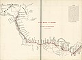
 FMIB 49364 First Cruise of H M S "Porcupine" -- 1869.jpeg 1,446 × 1,893; 616 KB
-
 FMIB 49365 Second Cruise of H M S "Porcupine" -- 1869.jpeg 1,864 × 1,400; 912 KB
-
 FMIB 49366 Third Cruise of HMS "Porcupine" -- 1869.jpeg 1,872 × 1,448; 1.02 MB
-
 Francesco Carletti.png 1,425 × 625; 45 KB
-
 Franklin Last Expedition Map.jpg 597 × 510; 98 KB
-
 Franklin Route german.jpg 1,168 × 546; 182 KB
-
 Franklin's lost expedition map ru.png 602 × 522; 42 KB
-
 Franklin's lost expedition map.png 602 × 520; 121 KB
-
 From Boston to Klondike or a trip to the gold regions. LOC 92686130.jpg 8,408 × 6,155; 4.99 MB
-
 Hajóút térképe - Map of cruise - panoramio.jpg 800 × 600; 350 KB
-

-
 HMSO Graf Spee cruise.jpg 784 × 516; 82 KB
-
 Il viaggio di Odisseo.png 731 × 379; 69 KB
-

-

-

-
 Journal of three voyages along the coast of China - Map of the Coast of Siam China.jpg 1,938 × 2,306; 504 KB
-
 Journey Mary Ann 1839-1841.png 800 × 525; 23 KB
-

-
 Le Maire en Schouten - Reis via Kaap Hoorn naar Indie 1615-1616.png 1,021 × 474; 60 KB
-
 Location of Costa Concordia cruise-ship disaster (13-1-2012)-2.png 978 × 797; 285 KB
-
 Luke Foxe voyage account (North-West Fox, 1635) - 2 foldout map -1 full view.png 5,742 × 4,226; 39.96 MB
-
 Luke Foxe voyage account (North-West Fox, 1635) - 3 foldout map - 2 Hudson Bay.png 1,539 × 1,360; 4.46 MB
-
 MalaspinaRouteMap.png 781 × 585; 100 KB
-
 Map galilee cruises 123.jpg 678 × 483; 138 KB
-
 Map of HMAS Sydney (II) winter cruise, 1939 (27340403456).jpg 1,200 × 1,038; 255 KB
-
 Map of the 70000 Tons of Metal Cruise (2012).jpg 1,454 × 973; 240 KB
-
 Map of the 70000 Tons of Metal Cruise.jpg 432 × 328; 26 KB
-
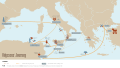
 Map of the Central and Eastern Mediterranean Sea, showing Aeneas' journeys.jpg 13,070 × 9,643; 20.18 MB
-
 Map of the Frigate Chesapeake's First War of 1812 Cruise.png 1,930 × 1,654; 1.02 MB
-
 Map of the voyage of Aeneas by Abraham Ortelius.jpeg 1,536 × 1,180; 554 KB
-
 Map-benedetto.png 800 × 370; 11 KB
-
 Mapka wyprawy kajakowej Łowicki Pielgrzym II.jpg 1,968 × 1,290; 410 KB
-
-
 Maps illustrating cruises of John Paul Jones in British waters (10175546456).jpg 4,029 × 5,175; 3.86 MB
-
 Maps of the peregrination of Ulysses by Abraham Ortelius.jpeg 3,012 × 2,363; 2.28 MB
-
 Mini650map.jpg 1,500 × 2,122; 2.76 MB
-
 Minitransat.jpg 406 × 349; 36 KB
-
 Moitessier Voyage Joshua 1963-1966 map-fr.svg 1,732 × 1,124; 239 KB
-
 Moitessier Voyage Joshua 1968-1969 map-fr.svg 3,040 × 1,396; 514 KB
-
 Moitessier Voyage Marie-Thérèse 1952 map-fr.svg 1,200 × 800; 119 KB
-
 Moitessier Voyage Marie-Thérèse II 1955-1958 map-fr.svg 1,424 × 958; 111 KB
-
 Moitessier Voyage Snark 1951 map-fr.svg 923 × 1,104; 118 KB
-
 Nansen Fram Expedition map-fr.svg 1,000 × 600; 70 KB
-
 Nansen Franz Josef Land voyage map-fr.svg 599 × 437; 200 KB
-
 Nansen Franz Josef Land voyage map-no.png 600 × 438; 77 KB
-
 Nansen Franz Josef Land Voyage Map.PNG 1,017 × 683; 118 KB
-
 Nansen Franz Josef Land voyage map.svg 600 × 438; 400 KB
-
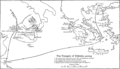
 Navarino.svg 1,430 × 979; 189 KB
-
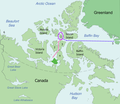
 New South Greenland Map eo.png 400 × 346; 14 KB
-
 New South Greenland Map ua.jpg 398 × 344; 109 KB
-
 New South Greenland Map-blank.png 400 × 346; 8 KB
-
 New South Greenland Map-es.png 400 × 346; 17 KB
-
 New South Greenland Map-fr.png 400 × 346; 11 KB
-
 New South Greenland Map.png 398 × 344; 4 KB
-
 New South Greenland MapZh.png 398 × 344; 26 KB
-
 Nueva Groenlandia del Sur.jpg 400 × 346; 29 KB
-
 Odysseus' Journey.svg 1,920 × 1,080; 497 KB
-
 Odyssey (Butler) Map.png 2,879 × 1,646; 491 KB
-
 Orthodromic vs loxodromic.png 1,501 × 1,127; 54 KB
-
 Ortogonalis polikonikus kepzetes kupvetulet.svg 1,381 × 927; 2.91 MB
-
 ParkerNavyMapAtlantic.jpg 1,058 × 498; 71 KB
-
 ParkNavyMapSA.jpg 915 × 875; 116 KB
-
 Roche-Route.PNG 623 × 559; 524 KB
-
 Route of Aeneas in the Mediterranean Sea by tom sulcer.jpg 800 × 585; 405 KB
-
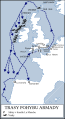 Routes of the Spanish Armada cs.svg 411 × 753; 168 KB
-
 Routes of the Spanish Armada-es.svg 411 × 753; 172 KB
-
 Routes of the Spanish Armada-zh-classical.png 415 × 756; 22 KB
-
 Routes of the Spanish Armada.gif 415 × 756; 27 KB
-
 Schouten,Spielbergen.png 1,425 × 625; 47 KB
-
 Shackleton Endurance Aurora map ua.png 502 × 617; 15 KB
-
 ShackletonEndurancecarta it.jpg 502 × 617; 153 KB
-
 Soya course to Antarctica.svg 1,500 × 775; 240 KB
-
 St. Francis Xavier - Asia Voyages.svg 1,400 × 900; 209 KB
-
 Surcouf cruise-1b.svg 1,664 × 1,664; 167 KB
-
 Surcouf cruise-2b.svg 1,664 × 1,664; 169 KB
-
 Surcouf cruise-5b.svg 1,664 × 1,664; 168 KB
-
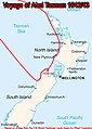 Tasman1642.jpg 323 × 454; 33 KB
-
 The first Antarctic voyage (1839) of the Wilkes expedition-fr.svg 4,552 × 3,458; 636 KB
-
 The first Antarctic voyage (1839) of the Wilkes expedition-ru.svg 4,552 × 3,458; 1.04 MB
-
 The German East Asia Squadron 1914 1915-en.svg 3,100 × 1,600; 1.57 MB
-

-
 Third expedition of Willem Barentsz (1596–1597)-ka.svg 1,140 × 940; 1.06 MB
-
 Thomas-Stevens's-bicycle-journey-DE.png 2,156 × 1,000; 643 KB
-
 Thomas-Stevens's-bicycle-journey-EN.jpg 2,207 × 1,024; 523 KB
-
 Thomas-Stevens's-bicycle-journey-EN.png 2,156 × 1,000; 673 KB
-
 Thomas-Stevens's-bicycle-journey-FR.svg 1,377 × 616; 976 KB
-
 Titanicmap.png 431 × 179; 3 KB
-
 Trade routes with russia(old).png 1,499 × 907; 815 KB
-
 TrindadeMapCruiseOfTheAlerte.jpg 1,654 × 1,120; 585 KB
-
 Un-Cruise Adventures - B.C.'s Yachters' Paradise (itinerary map).jpg 600 × 471; 245 KB
-
 Un-Cruise Adventures - Baja's Whale Bounty (itinerary map).jpg 2,250 × 1,453; 1.75 MB
-
 Un-Cruise Adventures - Isla Esencial - Baja Calif. Sur y Norte (itinerary map).jpg 2,250 × 1,610; 1.41 MB
-
 Un-Cruise Adventures - Milagros Maritimos de Baja Calif. (itinerary map).jpg 2,250 × 1,593; 1.36 MB
-
 USS Knight (DD-633) World War II war cruises map (UA 571.24).jpg 1,603 × 1,259; 975 KB
-
 Viikinkien retket.png 1,236 × 857; 406 KB
-
 Vikingenes ferdesveier og bosetninger.png 1,236 × 857; 330 KB
-
 Vikings exploration and territories-en.svg 1,500 × 600; 358 KB
-
 Vikings exploration and territories-fr.svg 1,500 × 600; 358 KB
-
 Vikings exploration and territories-hu.svg 1,500 × 600; 358 KB
-
 Vikings-Voyages-he.png 947 × 648; 739 KB
-
 Vikings-Voyages.png 800 × 547; 535 KB
-
 Vinland karta, Nordisk familjebok.png 1,044 × 1,398; 122 KB
-
 Voyage ingraham.svg 1,266 × 616; 450 KB
-
 Voyage of the Beagle-de.svg 1,024 × 432; 89 KB
-
 Voyage of the Beagle-el.svg 1,024 × 432; 174 KB
-
 Voyage of the Beagle-en.svg 1,024 × 512; 75 KB
-
 Voyage of the Beagle-fr.svg 1,024 × 512; 81 KB
-
 Voyage of the Beagle-key.svg 1,024 × 512; 74 KB
-
 Voyage of the Beagle-nl.svg 1,024 × 432; 91 KB
-
 Voyage-Jacques Siegfried.jpg 1,514 × 416; 182 KB
-
 Weltrundfahrt Map 1929.jpg 1,083 × 914; 168 KB
-
 Züge, Landnahmen und Siedlungsgebiete der Nordmänner - 800-1050.png 4,026 × 2,502; 12.13 MB
-
 Маршрут Испанской экспедиции (1725-1726).PNG 1,888 × 1,702; 2.98 MB


_-_Geographicus_-_SouthPole-covensmortier-1741.jpg)

.jpg)


_-_Geographicus_-_Tahiti-hogg-1780.jpg)


_-_Geographicus_-_NorthwestPassage-schraembl-1788.jpg)

_-_Geographicus_-_WesternHemisphere-cary-1799.jpg)

_-_Geographicus_-_EasternHemisphere-cary-1801.jpg)


_-_Geographicus_-_HemiWest-t-1814.jpg)

_-_Geographicus_-_WorldEH-pinkerton-1818.jpg)
_-_Geographicus_-_World-colton-1852.jpg)


_p008_MAP_given_to_The_Cruise_round_the_World_of_the_Flying_Squadron_1869-1870.jpg)
_p053_Map_of_the_Cruise_Paspebiac_to_the_Magdalen_Isles.jpg)
_p061_Map_of_the_Cruise_from_the_Magdalenen_Islands_to_Cape_St._George.jpg)
_p098_Map_of_the_Cruise_from_the_Bay_of_Islands_to_St._Pierre.jpg)


_(14596834098).jpg)
_(14760487496).jpg)
_(14783135852).jpg)


_-_Isaac_La_Peyr%C3%A8re_-_1_full.png)


.png)


.jpg)


_-_3_fig_2_-_map_of_Hudson_Strait_and_Hudson_Bay.png)
_-_4_double_page_with_fig_3_-_Winter_Harbour.png)
_-_5_fig_3_-_Winter_Harbour_at_Churchill_River_-_1_full.png)


_door_Willem_Barendsz_(titel_op_object),_NG-800.jpg)

-2.png)
_-_2_foldout_map_-1_full_view.png)
_-_3_foldout_map_-_2_Hudson_Bay.png)


_winter_cruise,_1939_(27340403456).jpg)
.jpg)


.jpg)


_Map.png)


_of_the_Wilkes_expedition-fr.svg)
_of_the_Wilkes_expedition-ru.svg)

_-_2_foldout_map_The_Platt_of_Sayling_-_1_full_view.png)
-ka.svg)


.png)

.jpg)
.jpg)
.jpg)
.jpg)
_World_War_II_war_cruises_map_(UA_571.24).jpg)


.PNG)
_p127_Map_of_the_Cruise_from_St._Pierre_to_Georgetown.jpg)
_(14778104325).jpg)