Category:Maps of volcanic eruptions in Chile
Jump to navigation
Jump to search
Subcategories
This category has the following 3 subcategories, out of 3 total.
Media in category "Maps of volcanic eruptions in Chile"
The following 5 files are in this category, out of 5 total.
-
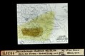
 Calcubo Ash 04-26-2015.jpg 1,000 × 700; 653 KB
-
-
 Gravity Waves Associated with Calbuco Volcanic Eruption, 23 April, 2015.png 1,415 × 979; 637 KB
-
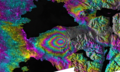 Ground Deformation from Chilean Volcanic Eruption Shown by Satellite Radar Image.png 2,881 × 1,729; 13.81 MB
-
 Tracking the Sulfur Dioxide from Calbuco.jpg 720 × 480; 163 KB


