Category:Maps of villages in Ohio
Jump to navigation
Jump to search
Subcategories
This category has the following 42 subcategories, out of 42 total.
*
A
- Maps of Adena, Ohio (9 F)
- Maps of Ashville, Ohio (15 F)
- Maps of Attica, Ohio (11 F)
B
- Maps of Barton, Ohio (3 F)
- Maps of Belle Center, Ohio (7 F)
- Maps of Bradner, Ohio (2 F)
C
- Maps of Caledonia, Ohio (5 F)
K
- Maps of Kelleys Island, Ohio (7 F)
M
- Maps of Beloit, Ohio (6 F)
- Maps of Bethel, Ohio (17 F)
- Maps of Bowerston, Ohio (6 F)
- Maps of Bremen, Ohio (2 F)
- Maps of Byesville, Ohio (32 F)
- Maps of Carroll, Ohio (2 F)
- Maps of Castalia, Ohio (2 F)
- Maps of Centerburg, Ohio (14 F)
- Maps of Chesapeake, Ohio (3 F)
- Maps of Vanlue, Ohio (3 F)
Media in category "Maps of villages in Ohio"
The following 49 files are in this category, out of 49 total.
-
-
-
-
-
-
-
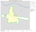
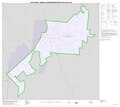
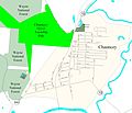 Chauncey Ohio.jpg 2,973 × 2,550; 589 KB
-
 Detailed map of Beaver, Ohio.png 575 × 425; 17 KB
-
 Detailed map of Buchtel, Ohio.png 575 × 425; 25 KB
-
 Detailed map of Clifton, Ohio.png 575 × 425; 16 KB
-
 Detailed map of Coalton, Ohio.png 575 × 425; 18 KB
-
 Detailed map of Coldwater, Ohio.png 575 × 425; 25 KB
-
 Detailed map of Covington, Ohio.png 573 × 423; 39 KB
-
 Detailed map of De Graff, Ohio.png 575 × 425; 32 KB
-
 Detailed map of Elmore, Ohio.png 575 × 425; 38 KB
-
 Detailed map of Elmwood Place.png 575 × 425; 32 KB
-
 Detailed map of Forest, Ohio.png 573 × 423; 35 KB
-
 Detailed map of Hamden in Ohio.png 575 × 425; 24 KB
-
 Detailed map of Hills and Dales in Ohio.png 575 × 425; 26 KB
-
 Detailed map of Holmesville, Ohio.png 575 × 425; 14 KB
-
 Detailed map of Huntsville, Ohio.png 575 × 425; 17 KB
-
 Detailed map of Lakeview, Ohio.png 575 × 425; 21 KB
-
 Detailed map of Laurelville, Ohio.png 575 × 425; 22 KB
-
 Detailed map of McArthur in Ohio.png 575 × 425; 22 KB
-
 Detailed map of Mendon, Ohio.png 573 × 423; 15 KB
-
 Detailed map of Miltonsburg, Ohio.png 575 × 425; 9 KB
-
 Detailed map of Murray City, Ohio.png 575 × 425; 20 KB
-
 Detailed map of Oak Hill, Ohio.png 575 × 425; 26 KB
-
 Detailed map of Old Washington.png 575 × 425; 22 KB
-
 Detailed map of Piketon, Ohio.png 575 × 425; 23 KB
-
 Detailed map of Quincy, Ohio.png 575 × 425; 16 KB
-
 Detailed map of Ridgeway, Ohio.png 575 × 425; 15 KB
-
 Detailed map of Rushsylvania, Ohio.png 575 × 425; 17 KB
-
 Detailed map of Russells Point, Ohio.png 575 × 425; 28 KB
-
 Detailed map of St. Bernard.png 575 × 425; 41 KB
-
 Detailed map of Valley Hi, Ohio.png 575 × 425; 16 KB
-
 Detailed map of Versailles, Ohio.png 575 × 425; 25 KB
-
 Detailed map of Waverly, Ohio.png 575 × 425; 36 KB
-
 Detailed map of West Liberty, Ohio.png 575 × 425; 24 KB
-
 Detailed map of Wilkesville.png 575 × 425; 16 KB
-
 Detailed map of Zaleski.png 575 × 425; 20 KB
-
 Detailed map of Zanesfield.png 575 × 425; 14 KB
-
 Detailed map of Zoar, Ohio.png 575 × 425; 25 KB
-
 Fredericksburg map 2.PNG 383 × 376; 12 KB
-
 Glouster ohio.JPG 3,841 × 2,458; 779 KB
-
 Jacksonville Ohio.jpg 4,320 × 2,880; 692 KB
-
 Ohimage.PNG 793 × 534; 164 KB
-
 Ottawahillsplatmap.gif 800 × 715; 140 KB
-
 Trimble ohio.jpg 2,923 × 2,490; 516 KB


