Category:Maps of the regions of Greece
Jump to navigation
Jump to search
Countries of Europe: Greece
Subcategories
This category has the following 6 subcategories, out of 6 total.
M
Media in category "Maps of the regions of Greece"
The following 61 files are in this category, out of 61 total.
-
 Attica periphery.svg 3,825 × 3,277; 720 KB
-
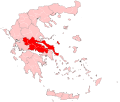 Central Greece periphery.svg 3,909 × 3,312; 720 KB
-
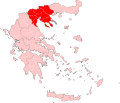 Central Macedonia periphery.svg 3,825 × 3,277; 718 KB
-
 Greece (ancient) Central (cropped).svg 1,937 × 1,253; 1.75 MB
-
 Greece (ancient) Chalcidice (cropped).svg 1,591 × 1,204; 1.75 MB
-
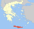
 Greece (ancient) Crete (cropped).svg 2,743 × 1,313; 1.75 MB
-
 Greece (ancient) Epirus (cropped).svg 1,740 × 1,559; 1.76 MB
-
 Greece (ancient) Euboea (cropped).svg 1,599 × 1,229; 1.75 MB
-
 Greece (ancient) IonianIslands (cropped).svg 1,161 × 1,815; 1.75 MB
-
 Greece (ancient) Macedonia (cropped).svg 2,697 × 1,837; 1.75 MB
-
 Greece (ancient) NorthAegean (cropped).svg 1,839 × 2,761; 1.75 MB
-
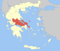
 Greece (ancient) Peloponnesus (cropped).svg 2,108 × 2,411; 1.75 MB
-
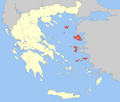
 Greece (ancient) SouthAegean (cropped).svg 3,546 × 2,844; 1.75 MB
-
 Greece (ancient) Thessaly (cropped).svg 2,695 × 1,393; 1.75 MB
-
 Greece 2011 subdivisions blank.svg 8,637 × 7,563; 2.54 MB
-
 Greece 2011 subdivisions de.svg 8,637 × 7,563; 2.74 MB
-
 Greece 2011 subdivisions-hu.svg 8,637 × 7,563; 2.24 MB
-
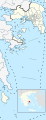 Greece Attica region location map.svg 1,053 × 2,738; 4.18 MB
-
 Greece Base Map.png 1,104 × 697; 592 KB
-
 GreeceAttica.png 200 × 204; 28 KB
-
 GreeceCentral.png 200 × 204; 21 KB
-
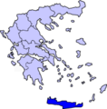 GreeceCrete.png 200 × 204; 21 KB
-
 GreeceEastMacedoniaThrace.png 200 × 204; 21 KB
-
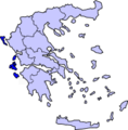
 GreeceEpirus.png 200 × 204; 16 KB
-
 GreeceIonianIslands.png 200 × 204; 21 KB
-
 GreeceNorthAegean.png 200 × 204; 16 KB
-
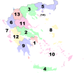
 GreeceNumberedPerepheries.png 400 × 408; 68 KB
-
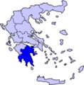 GreecePeloponnesus.png 200 × 204; 21 KB
-
 GreecePeloponnesusBettermap.png 200 × 204; 21 KB
-
 GreecePeripheriesBlank.png 800 × 679; 120 KB
-
 GreeceSouthAegean.png 200 × 204; 16 KB
-
 GreeceThessaly.png 200 × 204; 21 KB
-
 GreeceWest.png 200 × 204; 18 KB
-
 GreeceWestMacedonia.png 200 × 204; 16 KB
-
 GreekPerepheriesBlank.png 788 × 804; 30 KB
-
 Iera Koinotis Agiou Orous.png 800 × 679; 91 KB
-
 IonianIslandsGreekRegion.png 200 × 204; 21 KB
-
 Kallikratis dioikisi numbers.png 1,511 × 1,370; 149 KB
-
 Kallikratis dioikisi.png 1,511 × 1,370; 135 KB
-
 Map of the highest level administrative divisions of Greece.svg 800 × 685; 35.58 MB
-
 Peloponnese periphery.svg 3,909 × 3,312; 719 KB
-
 Perifereies.png 400 × 408; 60 KB
-
 Periferia Anatolikis Makedonias ke Thrakis.png 800 × 679; 91 KB
-
 Periferia Attikis.png 800 × 679; 92 KB
-
 Periferia Dytikis Elladas.png 800 × 679; 92 KB
-
 Periferia Dytikis Makedonias.png 800 × 679; 91 KB
-
 Periferia Ionion Nision.png 800 × 679; 92 KB
-
 Periferia Ipirou.png 800 × 679; 92 KB
-
 Periferia Kritis.png 800 × 679; 91 KB
-
 Periferia Notiou Egeou.png 800 × 679; 92 KB
-
 Periferia Peloponnisou.png 800 × 679; 92 KB
-
 Periferia Stereas Elladas.png 800 × 679; 92 KB
-
 Periferia Thessalias.png 800 × 679; 92 KB
-
 Periferia Voriou Egeou.png 800 × 679; 93 KB
-
 Peripheries of Greece numbered.svg 8,460 × 7,315; 2 MB
-
 Peripheries of Greece renumbered.svg 7,304 × 7,315; 2.59 MB
-
 Peripheries of Greece.png 200 × 204; 16 KB
-
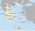
 Subdivisions of Greece (1930).svg 7,460 × 7,505; 2.36 MB
-
 VerwaltungsbereicheGriechenlands.png 294 × 300; 21 KB
-
 West Greece periphery.svg 3,909 × 3,312; 720 KB
-
 WesternGreeceRegion.png 200 × 204; 21 KB


_Central_(cropped).svg)
_Chalcidice_(cropped).svg)
_Crete_(cropped).svg)
_Epirus_(cropped).svg)
_Euboea_(cropped).svg)
_IonianIslands_(cropped).svg)
_Macedonia_(cropped).svg)
_NorthAegean_(cropped).svg)
_Peloponnesus_(cropped).svg)
_SouthAegean_(cropped).svg)
_Thessaly_(cropped).svg)


.svg)


