Category:Maps of the municipality of Argos-Mykines
Jump to navigation
Jump to search
Wikimedia category | |||||
| Upload media | |||||
| Instance of | |||||
|---|---|---|---|---|---|
| Category combines topics | |||||
| Argos-Mykines Municipality | |||||
municipality in Peloponnese, Greece _-_1.JPG)  | |||||
| Instance of | |||||
| Named after | |||||
| Location | Argolis Regional Unit, Peloponnese Region, Decentralized Administration of Peloponnese, Western Greece and the Ionian Islands, Greece | ||||
| Capital | |||||
| Head of government |
| ||||
| Headquarters location | |||||
| Inception |
| ||||
| Population |
| ||||
| Area |
| ||||
| official website | |||||
 | |||||
Subcategories
This category has the following 2 subcategories, out of 2 total.
M
- Maps of ancient Argos (5 F)
Media in category "Maps of the municipality of Argos-Mykines"
The following 18 files are in this category, out of 18 total.
-
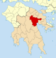
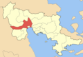
 2010 Dimos Argous-Mykinon.svg 1,300 × 900; 49 KB
-
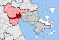
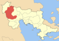
 2011 Dimos Argous-Mykinon.png 1,000 × 1,032; 183 KB
-
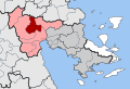
 DE Achladokambou.svg 453 × 309; 495 KB
-
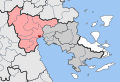
 DE Aleas.svg 453 × 309; 495 KB
-
 DE Argous.svg 453 × 309; 495 KB
-
 DE Koutsopodiou.svg 453 × 309; 495 KB
-
 DE Lernas.svg 453 × 309; 495 KB
-
 DE Lyrkias.svg 453 × 309; 495 KB
-
 DE Mykineon.svg 453 × 309; 495 KB
-
 DE Neas Kiou.svg 453 × 309; 495 KB
-
 Dimos Argous.png 500 × 347; 51 KB
-
 Dimos Koutsopodiou.png 500 × 347; 51 KB
-
 Dimos Lernas.png 500 × 347; 51 KB
-
 Dimos Lyrkeias.png 500 × 347; 51 KB
-
 Dimos Mykineon.png 500 × 347; 51 KB
-
 Dimos Neas Kiou.png 500 × 347; 51 KB
-
 Koinotita Ahladokampou.png 500 × 347; 51 KB
-
 Koinotita Aleas.png 500 × 347; 51 KB


