Category:Maps of the island of Korčula
Jump to navigation
Jump to search
Subcategories
This category has only the following subcategory.
O
Media in category "Maps of the island of Korčula"
The following 8 files are in this category, out of 8 total.
-

-
 Admiralty Chart No 2713 Adriatic sheet V Curzola (Korčula) to Cattaro (Kotor), Published 1878.jpg 11,866 × 8,023; 12.02 MB
-
 Admiralty Chart No 2713 Igrane, Published 1961.jpg 11,232 × 16,367; 15.64 MB
-
 Admiralty Chart No 3906 Krilo and Igrane to Otok Lastovo, Published 1963.jpg 11,056 × 16,228; 40.13 MB
-
 Croatia - Korcula.PNG 693 × 547; 15 KB
-
 Curzola.png 2,134 × 908; 2.48 MB
-
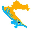 Korcula in croatia.jpg 120 × 112; 5 KB
-
 Korčula-općine.PNG 910 × 477; 22 KB
_Channel_to_Curzola_(Kor%C4%8Dula),_Published_1877.jpg)
_to_Cattaro_(Kotor),_Published_1878.jpg)


