Category:Maps of the history of the canton of Bern
Jump to navigation
Jump to search
Cantons of Switzerland: Bern (BE) · Fribourg (FR) · Geneva (GE) · Graubünden (GR) · Valais (VS) · Vaud (VD) · Zürich (ZH)
Use the appropriate category for maps showing all or a large part of Bern. See subcategories for smaller areas:
| If the map shows | Category to use |
|---|---|
| Bern on a recently created map | Category:Maps of Canton of Bern or its subcategories |
| Bern on a map created more than 70 years ago | Category:Old maps of Canton of Bern or its subcategories |
| the history of Bern on a recently created map | Category:Maps of the history of Canton of Bern or its subcategories |
| the history of Bern on a map created more than 70 years ago | Category:Old maps of the history of Canton of Bern or its subcategories |
Media in category "Maps of the history of the canton of Bern"
The following 27 files are in this category, out of 27 total.
-
 Bailliage d'Aarberg.png 387 × 367; 77 KB
-
 Bailliage d'Oltigen.png 374 × 296; 71 KB
-
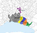 Bailliage Lausanne.png 491 × 449; 134 KB
-
 Bailliage Vevey.png 764 × 704; 108 KB
-
 Bailliages bernois Vaud 1536-1539.png 2,897 × 2,518; 2.05 MB
-
 Bailliages bernois Vaud 1539-1555.png 2,897 × 2,518; 2.08 MB
-
 Baronnie Frutigen.png 628 × 596; 138 KB
-
 Berner Aargau.png 2,000 × 2,111; 494 KB
-
 Berner-Vogteien-im-Kanton-Waadt fr.png 2,000 × 1,867; 454 KB
-
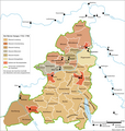
 Bernische-Vogteien-Kanton-Waadt.png 2,897 × 2,518; 1.63 MB
-
 Brenodor.jpg 400 × 475; 133 KB
-
 Burgunderkriege.png 2,500 × 2,527; 1.13 MB
-
 Carte-Royaume-dArles.png 1,500 × 1,529; 412 KB
-
 Châtellenie Niedersimmental.png 940 × 840; 364 KB
-
 Châtellenie Obersimmental.png 940 × 840; 364 KB
-
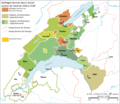
 Karte Bernische-Vogteien-Kanton-Waadt en.png 2,000 × 1,738; 477 KB
-
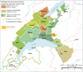
 Karte Bernische-Vogteien-Kanton-Waadt fr.png 2,000 × 1,738; 477 KB
-
 Karte Stadtstaat Bern vereinfacht-EN.png 2,000 × 1,655; 615 KB
-
 Karte Stadtstaat Bern vereinfacht.png 2,000 × 1,655; 604 KB
-
 Karte Stadtstaat Bern version-für-svgexport.png 4,000 × 3,401; 1.25 MB
-
 Karte Stadtstaat Bern Wachstum.png 2,500 × 2,060; 957 KB
-
 Karte Stadtstaat Bern.svg 1,160 × 997; 470 KB
-
 Les districts jurassiens.png 3,077 × 2,092; 600 KB
-
 Map of the jurassic districts.png 3,077 × 2,092; 594 KB
-
 Struktur Eidgenossenschaft 1474-fr.svg 2,500 × 1,518; 322 KB
-
 Übersichtskarte Jurakonflikt.png 3,077 × 2,092; 606 KB
-
 Übersichtskarte Jurakonflikt.svg 923 × 628; 1.99 MB


