Category:Maps of the history of the City of London
Jump to navigation
Jump to search
Ceremonial counties of England: Greater London · Lancashire ·
City-counties: City of London
Former historic counties:
Other former counties:
City-counties: City of London
Former historic counties:
Other former counties:
Subcategories
This category has the following 2 subcategories, out of 2 total.
G
R
- Maps of Roman London (24 F)
Media in category "Maps of the history of the City of London"
The following 11 files are in this category, out of 11 total.
-

-
 A London Wall kapui.jpg 1,006 × 600; 79 KB
-
 City of London Bomb Damage Map.jpg 1,988 × 2,780; 2.74 MB
-
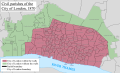 City of London civil parishes Map 1870.png 7,704 × 4,688; 5.82 MB
-
 City of London Ward Map, 1870.svg 1,213 × 801; 88 KB
-
 London 1300 Historical Atlas William R Shepherd (died 1934).PNG 700 × 536; 644 KB
-
 London Bridge attack map zh-cn.png 554 × 678; 202 KB
-
 LondonSavoy1300 Map.png 1,202 × 917; 304 KB
-
 Lübeck, Hansemuseum 2015e.jpg 4,076 × 2,844; 2.1 MB
-
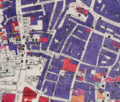 Noble Street and surrounding area Bombing, mapped in 1945.png 2,038 × 1,739; 7.09 MB
-
 The city of London in the late middle ages.png 544 × 384; 115 KB
.jpg)


.PNG)


