Category:Maps of the history of the Caucasus under Soviet rule
Jump to navigation
Jump to search
Subcategories
This category has only the following subcategory.
Media in category "Maps of the history of the Caucasus under Soviet rule"
The following 30 files are in this category, out of 30 total.
-
 1920 ռուս-թուրքական ագրեսիան.jpg 960 × 760; 111 KB
-
 Karta över de europeiska delarna av Sovjetunionen på 1920-talet.jpg 2,548 × 3,480; 1.81 MB
-
 Armenia Wilson Sevres treaty-Fr.png 588 × 411; 503 KB
-
 Baghirov Proposal.jpg 1,205 × 720; 320 KB
-
 Caucasiamapussr-ar.gif 739 × 623; 199 KB
-
 Caucasiamapussr.gif 700 × 590; 81 KB
-
 Caucasus under USSR as of 1989.jpg 3,185 × 2,679; 1.57 MB
-
 Chechen-Ingush Autonomous Oblast (1934–1936).svg 1,166 × 980; 181 KB
-
 GASSR.png 995 × 842; 181 KB
-
 Georgia 1921 AA.jpg 3,793 × 4,686; 3.41 MB
-
 Karachay.JPG 1,038 × 581; 82 KB
-
 Map of KarachaCherkessia.jpg 556 × 494; 54 KB
-
 North Caucasus Krai.png 592 × 599; 209 KB
-
 Osetija1956.jpg 7,000 × 5,322; 3.64 MB
-
 REAL GASSR.jpg 1,280 × 669; 124 KB
-
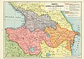
 SouthCaucasus.jpg 700 × 590; 135 KB
-
 Soviet Caucasus map CE.svg 747 × 629; 898 KB
-
 Soviet Caucasus map hu.svg 747 × 629; 281 KB
-
 Soviet Caucasus map-es.svg 2,424 × 2,000; 776 KB
-
 Soviet Caucasus map.svg 747 × 629; 731 KB
-
 Soviet Caucasus SSRs ASSRs and AOs 1989.jpg 364 × 567; 80 KB
-
 Soviet-caucasus1922Arabic.jpg 1,008 × 720; 89 KB
-
 Soviet caucasus1922.png 1,613 × 1,152; 127 KB
-
 Soviet-caucasus1922.png 1,613 × 1,090; 92 KB
-
 Treaty of Kars map.png 460 × 295; 64 KB
-
 Treaty of Sèvres &Soviet Republics of Transcaucasia.jpg 1,190 × 830; 1.16 MB
-
 USSR map Europe.jpg 2,202 × 3,079; 1.23 MB
-
 Карта Чеченской автономной области 1930 года.jpg 5,944 × 4,023; 3.33 MB
-
 Северо-Кавказский край (1930-34).png 2,000 × 2,304; 279 KB
-
 Чеченская автономная область 1928 (файл 2).jpg 1,166 × 980; 1.27 MB


.svg)


.png)
.jpg)