Category:Maps of the history of regions of France
Jump to navigation
Jump to search
Countries of Europe: France‡
Use the appropriate category for maps showing all or a large part of regions of France. See subcategories for smaller areas:
| If the map shows | Category to use |
|---|---|
| regions of France on a recently created map | Category:Maps of regions of France or its subcategories |
| regions of France on a map created more than 70 years ago | Category:Old maps of regions of France or its subcategories |
| the history of regions of France on a recently created map | Category:Maps of the history of regions of France or its subcategories |
| the history of regions of France on a map created more than 70 years ago | Category:Old maps of the history of regions of France or its subcategories |
Administrative regions and territorial collectivity of Metropolitan France (‡ since start of 2016):
Auvergne-Rhône-Alpes‡ · Bourgogne-Franche-Comté‡ · Bretagne · Centre-Val de Loire · Corsica · Grand Est‡ · Hauts-de-France‡ · Île-de-France · Normandie‡ · Nouvelle-Aquitaine‡ · Occitanie‡ · Pays de la Loire · Provence-Alpes-Côte d'Azur
Former administrative regions of Metropolitan France (until end of 2015):
Alsace · Aquitaine · Auvergne · Bourgogne · Champagne-Ardenne · Franche-Comté · Languedoc-Roussillon · Limousin · Lorraine · Midi-Pyrénées · Nord-Pas-de-Calais · Basse-Normandie · Haute-Normandie · Picardie · Poitou-Charentes · Rhône-Alpes
Overseas departments and regions: Guadeloupe · Martinique · French Guiana · Réunion · Mayotte
Overseas collectivities: Saint-Barthélemy · Saint-Martin (France) · Saint-Pierre and Miquelon · French Polynesia · Wallis and Futuna · the French Southern and Antarctic Lands+ ≈ French Southern and Antarctic Lands+
Sui generis territories: New Caledonia · Clipperton Island+

Subcategories
This category has the following 22 subcategories, out of 22 total.
'
- Maps of the history of Burgundy (70 F)
+
- Maps of the history of Réunion (16 F)
V
- Maps of Valois (5 F)
Media in category "Maps of the history of regions of France"
The following 24 files are in this category, out of 24 total.
-
 1789 + 2022 Auvergne-Rhône-Alpes, noms.png 1,416 × 1,209; 206 KB
-
 1789 + 2022 Bourgogne-Franche-Comté, noms.png 1,451 × 1,290; 222 KB
-
 1789 + 2022 Bretagne, noms.png 1,135 × 873; 101 KB
-
 1789 + 2022 France, noms des régions.png 4,264 × 4,098; 1.34 MB
-
 1789 + 2022 Grand Est, noms.png 1,583 × 1,125; 210 KB
-
 1789 + 2022 Hauts-de-France + Île, noms.png 866 × 1,378; 136 KB
-
 1789 + 2022 Normandie, noms.png 1,228 × 836; 117 KB
-
 1789 + 2022 Nouvelle Aquitaine, noms.png 1,361 × 1,895; 277 KB
-
 1789 + 2022 Occitanie, noms.png 1,483 × 1,260; 204 KB
-
 1789 + 2022 Pays de la Loire, noms.png 1,130 × 1,134; 150 KB
-
 1789 + 2022 Provence, noms.png 984 × 914; 100 KB
-
 1789 + 2022 Île-de-France216.png 2,025 × 1,554; 595 KB
-
 1789 et 2022, Centre-Val de Loire et Île-de-France, noms.png 1,200 × 1,368; 188 KB
-
 Medieval Ecclesiastical Divisions of France.jpg 3,010 × 3,890; 3.55 MB
-
 Carte 4 couleur.png 557 × 540; 73 KB
-
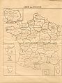 Carte ref 1969.JPG 2,400 × 3,244; 1.18 MB
-
 France 1789 + 2022.png 4,264 × 4,098; 1.26 MB
-
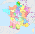
 France departements regions narrow.jpg 520 × 550; 68 KB
-
 France test Khardan.jpg 1,200 × 1,260; 167 KB
-
 France-region-demographie.png 1,052 × 556; 182 KB
-
 Map Southern France 1477-ru.png 888 × 383; 270 KB
-
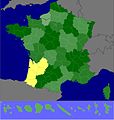
 Provence in France (1789 borders over modern Provence).png 1,920 × 1,845; 484 KB
-
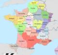
 Rattachismemap.png 836 × 843; 418 KB
-
 Régions culturelles en France.png 7,308 × 7,024; 8.66 MB


.png)

