Category:Maps of the history of colonies of Italy
Jump to navigation
Jump to search
Countries of Europe: Belgium · Denmark · France‡ · Germany · Italy · Netherlands‡ · Portugal‡ · Spain‡ · Sweden · United Kingdom
‡: partly located in Europe
‡: partly located in Europe
Subcategories
This category has the following 5 subcategories, out of 5 total.
M
- Maps of the Italian Somaliland (20 F)
- Maps of World War II in Libya (26 F)
Media in category "Maps of the history of colonies of Italy"
The following 19 files are in this category, out of 19 total.
-

-
 1908 Cordeaux-Sayyid frontier proposal.png 869 × 563; 47 KB
-
 Bellum1911-es.svg 1,945 × 1,228; 487 KB
-
 Bellum1911.png 2,533 × 1,549; 476 KB
-
 Colonisation italienne.PNG 338 × 322; 19 KB
-
 EritreaCampaign1941 map He.png 674 × 929; 175 KB
-
 GreaterItalia.jpg 759 × 625; 201 KB
-
 Italian Eritrea 1922.jpg 2,816 × 2,112; 1.64 MB
-
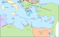
 ItalianMareNostrum.jpg 1,254 × 630; 319 KB
-
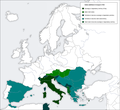 Italy aims Europe 1936.png 1,090 × 1,000; 156 KB
-
 Italy, Netherlands and Belgium 1934, 30.jpg 5,519 × 2,651; 1.67 MB
-
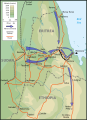 Map Eritrean Campaign 1941-en.svg 674 × 929; 120 KB
-
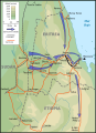 Map Eritrean Campaign 1941-es.svg 674 × 929; 100 KB
-
 Map Eritrean Campaign 1941-fr.svg 671 × 929; 97 KB
-
 Map Eritrean Campaign 1941-he.svg 674 × 929; 314 KB
-
 Map of Albania during WWII.png 647 × 839; 187 KB
-
 Mappa impero coloniale italiano piazza delle erbe.JPG 768 × 1,024; 139 KB
-
 Occupiedfrenchsomaliabyitalians1940.jpg 460 × 509; 112 KB
-
 Sfera italiana Turchia 1917.jpg 1,986 × 1,357; 532 KB
_usato_da_FIAT_(e_fiat_chrysler_automobiles)_per_il_suo_mercato_automobili.svg)


