Category:Maps of the history of Romania in ancient times
Jump to navigation
Jump to search
Countries of Europe: Albania · Bosnia and Herzegovina · Bulgaria · Croatia · Montenegro · North Macedonia · Romania · Serbia · Slovenia · Ukraine
Limited recognition: Kosovo
Limited recognition: Kosovo
Subcategories
This category has the following 2 subcategories, out of 2 total.
D
Media in category "Maps of the history of Romania in ancient times"
The following 67 files are in this category, out of 67 total.
-
 450 roman-hunnic-empire 1764x1116.jpg 1,764 × 1,116; 3.04 MB
-
 450 roman-hunnic-empire-es.svg 1,648 × 1,049; 2.25 MB
-
 450 roman-hunnic-empire-pt.svg 1,648 × 1,049; 3.11 MB
-
 Albanians as a migrant Dacian people.png 1,584 × 1,140; 455 KB
-
 AtlBalk400.jpg 318 × 327; 155 KB
-
 Balkans 200AD.png 436 × 313; 300 KB
-
 BALKANS ROMAN ROADS .jpg 1,686 × 1,239; 394 KB
-
 Central and Eastern Europe at the time of Augustus 6 AD.jpg 2,600 × 1,899; 740 KB
-
 Chernyakhov.PNG 777 × 471; 10 KB
-
 Chernyakhov.svg 737 × 452; 1.56 MB
-
 Costantino nord-limes png.PNG 2,660 × 1,532; 403 KB
-
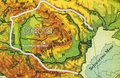
 Dacia (Imperium Romanum).PNG 2,495 × 1,775; 55 KB
-
 Dacia 82 BC bg.png 312 × 261; 32 KB
-
 Dacia 82 BC heb.png 650 × 544; 349 KB
-
 Dacia 82 BC.png 306 × 246; 53 KB
-
 Dacia 82 vChr.png 780 × 506; 1.02 MB
-
 Dacia around 100 AD - Italian.png 2,280 × 1,404; 1.07 MB
-
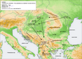
 Dacia around 60-44 BC during Burebista, including campaigns - Czech.png 2,901 × 1,866; 1.5 MB
-
 Dacia around 60-44 BC during Burebista, including campaigns - French.png 2,901 × 1,866; 1.35 MB
-
 Dacia around 60-44 BC during Burebista, including campaigns - Italian.png 2,901 × 1,866; 1.48 MB
-
 Dacia SPQR.png 800 × 548; 28 KB
-
 Dioecesis Thraciae 400 AD.png 461 × 352; 205 KB
-
 East Europe Archaeological Kievan-Chernyakhov.jpg 1,024 × 665; 350 KB
-
 Europe map 450-ar.png 800 × 580; 158 KB
-
 Europe map 450.PNG 800 × 580; 145 KB
-
 Gutthiuda.jpg 800 × 547; 460 KB
-
 Huns empire.png 998 × 571; 186 KB
-
 Huns450.png 719 × 697; 185 KB
-
 Huns450es.svg 3,202 × 2,535; 1.06 MB
-
 Iazyges-en.png 574 × 661; 30 KB
-
 Iazyges-es.svg 1,330 × 1,701; 186 KB
-
 Iazyges-pt.svg 1,330 × 1,701; 92 KB
-
 Iazyges-sr.png 574 × 661; 29 KB
-
 Limes and borders ka.gif 800 × 562; 48 KB
-
 Limes and borders.gif 800 × 562; 56 KB
-
 Map of Triballi tribe (English).jpg 558 × 396; 123 KB
-
 Map of Triballi tribe-es.svg 559 × 395; 200 KB
-
 Origins 300BC.png 498 × 407; 321 KB
-
 Prefecture of Illyricum map-sr.png 1,054 × 1,041; 92 KB
-
 Prefecture of Illyricum map-zh.png 1,054 × 1,041; 101 KB
-
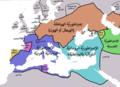
 Prefecture of Illyricum map.png 1,054 × 1,041; 103 KB
-
 PrefectureIllyricum.png 1,054 × 1,041; 96 KB
-
 REmpire-Dacia.png 400 × 296; 78 KB
-
 Roman Byzantine Gothic Walls Romania Plain.svg 1,500 × 1,300; 975 KB
-
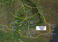
 Roman cities Vojvodina-sr.png 1,770 × 1,185; 133 KB
-
 Roman cities Vojvodina.png 1,770 × 1,185; 140 KB
-
 Roman Empire 125 (cropped).png 487 × 308; 171 KB
-
 Roman Empire 125 general map-zh.png 2,732 × 2,271; 6.07 MB
-
 Roman Empire 125 general map-zh.svg 2,732 × 2,271; 6.55 MB
-
 Roman Empire 125 general map.SVG 2,186 × 1,817; 1.77 MB
-
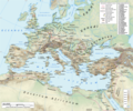
 Roman Empire 125 political map-de.svg 2,186 × 1,817; 6.32 MB
-
 Roman Empire 125 political map-zh.png 2,049 × 1,703; 2.99 MB
-
 Roman Empire 125 political map-zh.svg 2,732 × 2,271; 2.02 MB
-
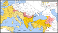
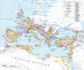
 Roman Empire 125 political map.png 2,186 × 1,817; 3.21 MB
-
 Roman Empire 125 political map.svg 2,186 × 1,817; 3.25 MB
-
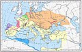
 Roman Empire 125.png 2,186 × 1,817; 4.43 MB
-
 Roman Empire Map AlexanderFindlay1849.png 2,038 × 1,828; 2 MB
-
 Roman Gothic Walls Romania Plain-pt.svg 512 × 444; 131 KB
-
 Roman Gothic Walls Romania Plain.svg 1,500 × 1,300; 335 KB
-
 Roman province of Dacia (106 - 271 AD)-es.svg 1,500 × 1,300; 802 KB
-
 Roman province of Dacia (106 - 271 AD)-pt.svg 512 × 444; 142 KB
-
 Roman province of Dacia (106 - 271 AD).svg 1,500 × 1,300; 392 KB
-
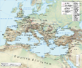
 Roman provinces in a 1867 school atlas.jpg 3,717 × 2,866; 969 KB
-
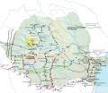
 Rumänien BV042751708.jpg 4,781 × 3,740; 1.44 MB
-
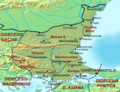
 Southeast Europe in the 450s AD.png 491 × 407; 340 KB
-
 Theoretical map of Romanian origins.png 972 × 751; 705 KB
-
 Tribalia diagrama.jpg 2,038 × 1,677; 2 MB


.PNG)


.jpg)


.png)


-es.svg)
-pt.svg)
.svg)


