Category:Maps of the history of Cologne
Jump to navigation
Jump to search
Use the appropriate category for maps showing all or a large part of Cologne. See subcategories for smaller areas:
| If the map shows | Category to use |
|---|---|
| Cologne on a recently created map | Category:Maps of Cologne or its subcategories |
| Cologne on a map created more than 70 years ago | Category:Old maps of Cologne or its subcategories |
| the history of Cologne on a recently created map | Category:Maps of the history of Cologne or its subcategories |
| the history of Cologne on a map created more than 70 years ago | Category:Old maps of the history of Cologne or its subcategories |
Media in category "Maps of the history of Cologne"
The following 9 files are in this category, out of 9 total.
-
 Cologne area growth red colours.svg 1,112 × 1,112; 1.18 MB
-
 DO-Ballei Koblenz.png 534 × 435; 17 KB
-
 Image-Roman Cologne, reconstruction2 praetorium.jpg 1,322 × 717; 148 KB
-
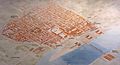 Image-Roman Cologne, reconstruction2.JPG 1,322 × 717; 149 KB
-
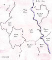 Köln-und-Nachbargaue.jpg 1,590 × 1,823; 790 KB
-
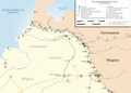 Limes1.png 3,277 × 2,362; 1.39 MB
-
 Proto-Franken1.png 1,199 × 920; 234 KB
-
 Roman Cologne, reconstruction.JPG 2,053 × 1,113; 783 KB
-
 Villenhaus+Burgus.jpg 992 × 717; 226 KB


