Category:Maps of the history of Bulgaria in modern times
Jump to navigation
Jump to search
Subcategories
This category has the following 2 subcategories, out of 2 total.
M
R
- Maps of refugees in Bulgaria (6 F)
Media in category "Maps of the history of Bulgaria in modern times"
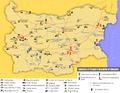
The following 184 files are in this category, out of 184 total.
-
 Bulgarien BV042515006 (cropped).jpg 1,485 × 1,109; 170 KB
-
 Bulgarien BV042515022 (cropped).jpg 924 × 1,244; 194 KB
-
 Bulgarien BV042515045 (cropped).jpg 909 × 1,340; 193 KB
-
 Bulgarien BV042516085 (cropped).jpg 1,558 × 1,689; 462 KB
-
 Bulgarien BV042516087 (cropped).jpg 1,508 × 685; 133 KB
-
 Bulgarien BV042516976 (cropped).jpg 2,063 × 1,534; 265 KB
-
 Bulgarien BV043420622 (cropped).jpg 1,461 × 1,076; 207 KB
-
 Bulgarien BV043420627 (cropped).jpg 1,573 × 1,044; 285 KB
-
 Bulgarien BV042760437 (cropped).jpg 1,916 × 1,485; 350 KB
-
 Bulgarien BV042775479.jpg 2,662 × 1,761; 470 KB
-
 Bulgarien BV042517305 (cropped).jpg 1,626 × 1,130; 305 KB
-
 Bulgarien BV042517328.jpg 2,667 × 1,845; 824 KB
-
 Bulgarien BV042517341 (cropped).jpg 1,582 × 1,502; 274 KB
-
 Bulgarien BV042517359 (cropped).jpg 1,418 × 1,289; 216 KB
-
 Bulgarien BV042753825.jpg 2,779 × 1,902; 701 KB
-
 Balkans1912.jpg 809 × 1,322; 201 KB
-
 Bulgarien BV042775493.jpg 2,840 × 1,773; 511 KB
-
 Map of Bulgaria (1885).jpg 3,932 × 2,425; 2.3 MB
-
 Bulgarien BV042515207 (cropped).jpg 1,540 × 1,356; 386 KB
-
 1913 Bati Trakya Turk Cumhuriyeti.jpg 550 × 333; 26 KB
-
 2nd-balkan-war-bulgarian-plan-sr.png 447 × 552; 59 KB
-
 2nd-balkan-war-bulgarian-plan.JPG 447 × 552; 112 KB
-
 2nd-balkan-war-bulgarian-plan.png 447 × 552; 80 KB
-
 8 primorski Balcan War.jpg 1,527 × 1,251; 924 KB
-
 Administrative divisions of Eastern Rumelia.PNG 1,083 × 526; 40 KB
-
 April Uprising.png 1,524 × 953; 660 KB
-
 Balkan Wars Boundaries.jpg 1,026 × 1,454; 571 KB
-
 Balkans 1912-13.jpg 559 × 600; 327 KB
-
 Balkans 1913-1918.jpg 559 × 600; 322 KB
-
 Balkans at 1913.jpg 1,800 × 2,391; 970 KB
-
 Balkans War Theatre.jpg 4,088 × 3,323; 5.41 MB
-
 Balkans1878 -1912.jpg 559 × 600; 316 KB
-
 Battle of Kresna Map.png 1,079 × 758; 1.2 MB
-
 BG Okolii.png 1,589 × 925; 115 KB
-
 BGTurks 1900.png 980 × 1,284; 1.6 MB
-
 Bulgaria 1915-1918.jpg 869 × 652; 452 KB
-
 Bulgaria admin 1998.png 546 × 368; 38 KB
-
 Bulgaria before Balkans Wars.jpg 469 × 369; 52 KB
-
 Bulgaria dopo Berlin Congress.png 559 × 375; 31 KB
-
 Bulgaria dopo la conferenza di Costantinopoli.png 1,165 × 853; 106 KB
-
 Bulgaria dopo Santo Stefano.png 700 × 508; 63 KB
-

-
 Bulgaria in 1879 geographic map-bg.svg 2,256 × 1,800; 15.78 MB
-
 Bulgaria in 1879 geographic map-es.svg 2,256 × 1,800; 16.57 MB
-
 Bulgaria in 1885 geographic map-bg.svg 2,256 × 1,800; 15.14 MB
-
 Bulgaria in 1885 geographic map-es.svg 2,256 × 1,800; 15.86 MB
-
 Bulgaria in 1913 geographic map-bg.svg 2,256 × 1,800; 14.54 MB
-
 Bulgaria in 1913 geographic map-es.svg 2,256 × 1,800; 15.19 MB
-
 Bulgaria in 1915 geographic map-bg.svg 2,256 × 1,800; 14.5 MB
-
 Bulgaria in 1915 geographic map-en.svg 2,256 × 1,800; 14.46 MB
-
 Bulgaria in 1915 geographic map-es.svg 2,256 × 1,800; 14.43 MB
-
 Bulgaria in 1919 geographic map-bg.svg 2,256 × 1,800; 14.67 MB
-
 Bulgaria in 1919 geographic map-es.svg 2,256 × 1,800; 15.48 MB
-
 Bulgaria in war.PNG 208 × 197; 114 KB
-
 Bulgaria-Boris-III.png 2,621 × 2,086; 34 KB
-
 Bulgaria-Constantinople-Conference.png 3,677 × 2,614; 52 KB
-
 Bulgaria-Ferdinand-I.png 2,641 × 2,031; 34 KB
-
 Bulgaria-San Stefano-Berlin 1878.jpg 786 × 613; 101 KB
-
 Bulgaria-SanStefano -(1878)-byTodorBozhinov.png 776 × 605; 176 KB
-
 Bulgaria-SanStefano-Congress of Berlin-1878.PNG 786 × 613; 423 KB
-
 Bulgarian acquisitions, treaty IX 1915-es.svg 1,085 × 1,675; 224 KB
-
 Bulgarian acquisitions, treaty IX 1915-fr.svg 1,414 × 1,583; 115 KB
-
 Bulgarian acquisitions, treaty IX 1915.jpg 1,085 × 1,675; 496 KB
-
 Bulgarian culture (1918-1939).png 1,794 × 1,276; 666 KB
-
 Bulgarian Exarchate.png 2,494 × 1,754; 791 KB
-
 Bulgarian National Revival.png 3,464 × 2,494; 1.04 MB
-
 Bulgarian national revolutionary movement in Macedonia and East Thrace (1893-1912).png 1,648 × 1,132; 960 KB
-
 Bulgarian unification and Serbo-Bulgarian War.png 1,407 × 1,030; 1.44 MB
-
 Bulgarian-Exarchate-1870-1913.jpg 1,576 × 1,580; 2.13 MB
-
 Bulgarian-turkish convention (1915).png 3,558 × 3,395; 724 KB
-
 Bulgarien 1878 (de).png 1,160 × 900; 289 KB
-
 Bulgarien BV042517290 (cropped).jpg 1,553 × 1,139; 287 KB
-
 Bulgarien BV042517354 (cropped).jpg 1,503 × 1,110; 174 KB
-
 Bulgarien BV042760527.jpg 2,037 × 2,952; 799 KB
-
 Bulgarien BV043421980 (cropped).jpg 1,856 × 2,014; 542 KB
-
 Bulgarien BV043421995 (cropped).jpg 1,090 × 960; 164 KB
-
 Bulgarien BV043422051 (cropped).jpg 1,584 × 1,110; 317 KB
-
 Bulgarien BV043422123 (cropped).jpg 1,580 × 1,112; 317 KB
-
 Bulgarien BV043422143 (cropped).jpg 852 × 742; 96 KB
-
 Bulgarien BV043557998 (cropped).jpg 1,564 × 1,092; 170 KB
-
 Bulgarien BV043558403 (cropped).jpg 1,146 × 844; 94 KB
-
 Bulgarien BV043564316 (cropped).jpg 1,506 × 1,107; 227 KB
-
 Bulgarien BV044859948.jpg 4,500 × 2,995; 6.48 MB
-
 Bulgária 1885.gif 536 × 472; 9 KB
-
 Bulgária 1913.gif 537 × 470; 11 KB
-
 Bulgária és a környező országok 1877.gif 536 × 472; 7 KB
-
 Bulgária és a környező országok 1878.gif 536 × 472; 10 KB
-
 Bulgária és a környező országok 1879.gif 536 × 472; 10 KB
-
 Campagne de Serbie (1915).svg 800 × 1,150; 160 KB
-
 Carte position des troupes par nationalité.jpg 933 × 386; 186 KB
-
 ConferenciaDeConstantinopla1876-1877.svg 2,620 × 1,867; 230 KB
-
 Europe 1878 map de.png 2,284 × 1,503; 1.01 MB
-
 Europe 1878 map en.png 2,284 × 1,503; 1.01 MB
-
 First Balkan war - liberated territories 1913.png 1,204 × 1,191; 666 KB
-
 First Balkan war - London Treaty negotiations 1912-13.jpg 2,489 × 1,738; 871 KB
-
 First Balkan War-hu.svg 347 × 313; 633 KB
-
 First Balkan War-tr.svg 347 × 313; 637 KB
-
 First Balkan War.SVG 347 × 313; 595 KB
-
 FR-WW1-1916-French-plans.png 3,223 × 2,324; 203 KB
-
 Front d'Orient et Serbie en juillet 1916.svg 800 × 1,150; 143 KB
-
 FronterasDeBulgariaSeg% C3% BAnSanStefanoYBerl% C3% ADn1878-nb.svg 781 × 606; 936 KB
-
 FronterasDeBulgariaSegúnSanStefanoYBerlín1878 hu.svg 781 × 606; 366 KB
-
 FronterasDeBulgariaSegúnSanStefanoYBerlín1878.svg 781 × 606; 936 KB
-
 Frontier defined by the Bulgarian–Ottoman Convention of 1915.png 1,500 × 3,000; 586 KB
-
 Gjg.JPG 921 × 1,645; 214 KB
-
 GuerrasBalcánicasLondresYBucarest.svg 1,027 × 1,242; 901 KB
-
 GuerrasBalcánicasLondresYBucarest2 de.svg 965 × 1,455; 1,008 KB
-
 GuerrasBalcánicasSituaciónPrebélica1912.svg 1,027 × 1,242; 888 KB
-
 Guerre balcaniche.png 1,044 × 1,578; 185 KB
-
 Guerres balkaniques - situation avant 1912.png 1,044 × 731; 65 KB
-
 Guerres balkaniques après traité de Bucarest.png 1,044 × 724; 100 KB
-
 Histdob.png 988 × 785; 179 KB
-
 I balcani nel 1905.png 1,362 × 2,000; 932 KB
-
 Industry of People's Republic of Bulgaria.png 1,646 × 1,270; 946 KB
-
 Itоgi Vtoroy Balkanskoy voini.png 350 × 300; 113 KB
-
 Karta2.gif 1,301 × 855; 1.01 MB
-
 Kingdom of Bulgaria (1914).svg 450 × 456; 456 KB
-
 Kvadriláter.jpg 277 × 300; 12 KB
-
 LocationPeoplesRepublicofBulgaria1988.png 990 × 497; 108 KB
-
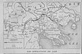
 LPDF 125 14 carte.jpg 941 × 581; 217 KB
-
 LPDF 61 5 carte 16 XII 1915.jpg 368 × 419; 145 KB
-
 LPDF 61 6 carte Babouna 16 déc 1915.jpg 379 × 295; 123 KB
-
 LPDF 63 5 déploiement des Alliés.jpg 703 × 441; 158 KB
-
 LPDF 98 15 carte du 31 août 1916.jpg 962 × 639; 217 KB
-
 Map Battle Simitli 1079 1378.jpeg 996 × 996; 276 KB
-
 Map of Bulgaria after Treaty of Neuilly-sur-Seine Western Thrace.png 1,280 × 999; 1.3 MB
-
 Map of the Balkan States (Miller, William, 1896).jpg 1,238 × 966; 433 KB
-
 Map of the First Balkan War.png 1,689 × 1,185; 775 KB
-
 MapaDeDobrudjaTratadoDeBucarest1918.svg 1,269 × 811; 294 KB
-
 MapaHistóricoDeDobrudja.svg 1,628 × 811; 92 KB
-
 Mediæval and modern history (1920) (14773848065).jpg 2,208 × 1,452; 771 KB
-
 Oblasti 1987-1998.png 546 × 368; 22 KB
-
 Oblasti de Bulgarie 1987-1999.png 548 × 361; 22 KB
-
 Okrazi 1901.png 553 × 343; 21 KB
-
 Okrazi 1949-1959.png 546 × 368; 25 KB
-
 Okrazi 1959-1987.png 546 × 363; 36 KB
-
 Okruzi 1882 (1).png 1,589 × 833; 78 KB
-
 Operations at the border of Greece and Serbia during WW1.jpg 1,242 × 961; 252 KB
-
 OttomanCession1915-fr.svg 1,240 × 1,637; 31 KB
-
 OttomanCession1915.png 620 × 900; 11 KB
-
 OttomanCessiontoBulgaria1915-de.svg 1,120 × 1,250; 2.75 MB
-
 OttomanCessiontoBulgaria1915.svg 1,120 × 1,250; 2.75 MB
-
 Povlacenje srpske vojske u PSR es.svg 806 × 930; 287 KB
-
 Povlacenje srpske vojske u PSR mk.svg 806 × 930; 171 KB
-
 Prima guerra balcanica.bg.png 1,005 × 1,022; 127 KB
-
 Principality of Bulgaria (1890).svg 450 × 456; 437 KB
-
 Protocol of Saint Petersburg 1913 map.png 1,739 × 1,067; 66 KB
-
 Results of the Treaty of Berlin 1878..jpg 5,120 × 7,352; 11.92 MB
-
 Romania-WW1-1.jpg 1,036 × 862; 149 KB
-
 Romania-WW1-2.jpg 974 × 898; 159 KB
-
 Romania-WW1-3.jpg 1,018 × 868; 159 KB
-
 Rumelia orientale.png 452 × 298; 25 KB
-
 Russian map of 1807 Romania in the Russian-Turkish War.jpg 918 × 1,268; 166 KB
-
 SanStefano1.jpg 1,004 × 768; 58 KB
-
 SanStefanoBalkan.jpg 1,112 × 857; 410 KB
-
 Sanstefanska Bulgaria.png 3,791 × 2,647; 1.9 MB
-
 Second Balkan War-es.svg 4,387 × 2,899; 1,009 KB
-
 Second Balkan War.png 1,710 × 1,371; 848 KB
-
 Serbia-WW1-3.jpg 868 × 918; 220 KB
-
 Serbo-Bulgarian War. Counteroffensive of the Bulgarian Army (22-27.XI.1885).png 2,682 × 1,866; 1.69 MB
-
 Tamrashka republika en.png 640 × 423; 65 KB
-
 Tamrashka republika es.svg 5,088 × 2,394; 336 KB
-
 Tamrashka republika.png 610 × 399; 48 KB
-
 Territorial aspirations of the Balkan states, 1912.jpg 969 × 770; 648 KB
-
 Territorial Evolution of the Modern Bulgarian State (1878–2023) - Map 3 (of 4).png 6,708 × 3,631; 1.87 MB
-
 Territorial Evolution of the Modern Bulgarian State (1878–2023) - Map 4 (of 4).png 6,648 × 3,085; 1.51 MB
-
 Territorial Evolution of the Modern Bulgarian State (1878–2023) Map 1 (of 4).png 6,607 × 3,171; 1.62 MB
-
 Territorial Evolution of the Modern Bulgarian State (1878–2023) Map 2 (of 4).png 6,763 × 3,274; 2.09 MB
-
 Territorial Modifications in the Balkans – Conference of London 1913.JPG 1,026 × 669; 430 KB
-
 The Balkan boundaries after 1913.jpg 646 × 852; 223 KB
-
 The Balkans, as per the Treaty of Bucharest of 1913.jpg 976 × 642; 187 KB
-
 The Contested Zone Defined in 1912 & Serbia's Claim to the Uncontested Zone in 1913.png 5,155 × 3,699; 4.92 MB
-

-
 Thrace Territory cession TurkeyBulgaria Oct1915.gif 500 × 657; 14 KB
-
 Zapadni pokrajnini.png 1,779 × 2,079; 219 KB
-
 Zapadni Pokrajnini.png 335 × 436; 58 KB
-
 Α' Βαλκανικός Πόλεμος.SVG 347 × 313; 594 KB
-
 Β' Βαλκανικός Πόλεμος.SVG 347 × 313; 592 KB
-
 Балканы в 1878.jpg 1,740 × 1,370; 797 KB
-
 Болгария (1885).jpg 2,649 × 1,558; 2.95 MB
-
 Карта Балкан по Сан-Стефанскому миру.jpg 1,912 × 1,465; 1.06 MB
-
-
 Оblasti 1934.png 546 × 366; 18 KB
-
 Оblasti 1935.png 546 × 367; 20 KB
.jpg)
.jpg)
.jpg)
.jpg)
.jpg)
.jpg)
.jpg)
.jpg)
.jpg)

.jpg)

.jpg)
.jpg)


.jpg)
.jpg)


.jpg)


-byTodorBozhinov.png)


.png)


.png)


.png)
.png)
.jpg)
.jpg)

.jpg)
.jpg)
.jpg)
.jpg)
.jpg)
.jpg)
.jpg)
.jpg)


.svg)


.svg)


.jpg)


_(14773848065).jpg)


.png)


.svg)


.png)


_-_Map_3_(of_4).png)
_-_Map_4_(of_4).png)
_Map_1_(of_4).png)
_Map_2_(of_4).png)


_(14778190151).jpg)


.jpg)

%D0%9D%D0%B5%D1%87%D0%B0%D0%B5%D0%B2.jpg)

