Category:Maps of the history of Ajaria
Jump to navigation
Jump to search
Media in category "Maps of the history of Ajaria"
The following 45 files are in this category, out of 45 total.
-
 1992 Georgia war.svg 1,940 × 1,370; 2.06 MB
-
 1992-1993 Georgia war.svg 1,940 × 1,370; 2.15 MB
-
 1993 Georgia war1.svg 1,940 × 1,370; 1.82 MB
-
 1993 Georgia war2.svg 1,940 × 1,370; 2.22 MB
-

-
 Batum map (Élisée Reclus).JPG 419 × 363; 54 KB
-
 Caucasiamapussr-ar.gif 739 × 623; 199 KB
-
 Caucasiamapussr.gif 700 × 590; 81 KB
-
 Caucasus 250 AD map alt de.png 2,990 × 2,324; 3.53 MB
-
 Caucasus 250 AD map alt de.svg 1,155 × 898; 4.46 MB
-
 Caucasus 250 AD map alt es.svg 1,155 × 898; 1.03 MB
-
 Caucasus 250 AD map alt pt.svg 1,155 × 898; 4.46 MB
-
 Caucasus 250 AD map de.png 2,990 × 2,324; 3.53 MB
-
 Caucasus 250 AD map de.svg 1,155 × 898; 4.45 MB
-
 Caucasus 250 AD map hu.svg 1,155 × 898; 4.45 MB
-
 Caucasus 290 BC map alt de.svg 1,155 × 898; 4.42 MB
-
 Caucasus 290 BC map de alt.png 3,000 × 2,332; 3.51 MB
-
 Caucasus 290 BC map de.svg 1,155 × 898; 4.42 MB
-
 Caucasus 290 BC map es.svg 1,155 × 898; 3.83 MB
-
 Caucasus 290 BC map hu.svg 1,155 × 898; 4.42 MB
-
 Caucasus 290 BC map ka.svg 1,155 × 898; 4.42 MB
-
 Caucasus 290 BC map pt.svg 1,155 × 898; 4.41 MB
-
 Caucasus 290 BD map de.png 3,000 × 2,332; 3.53 MB
-
 Covens et Mortier; Lisle, Guillaume de. 2. pte. Crimee, Mer Noire. 1742 (C).jpg 995 × 1,899; 343 KB
-
 Diaochi.png 274 × 195; 8 KB
-
 Diauehi.svg 770 × 550; 3.74 MB
-
 Georgian soviet republic1922-corrected.png 1,368 × 836; 62 KB
-
 Georgian soviet republic1922.png 1,368 × 836; 76 KB
-
 Georgian SSR 1922 hy.png 800 × 489; 97 KB
-
 Georgian soviet republic1957 1991.png 1,461 × 768; 63 KB
-
 Georgian soviet republic (1957-1991)-sr.png 1,461 × 768; 23 KB
-
 Georgian SSR 1957 hy.png 1,461 × 768; 44 KB
-
 Kingdom of Georgians ("Kingdom of Kartvels", Tao-Klarjeti), X c.jpg 1,882 × 2,379; 1.97 MB
-
 Kingdom of Georgians (Tao-Klarjeti), X c.jpg 1,882 × 2,379; 1.92 MB
-
 Kingdom of Imereti 1535-1545.svg 692 × 802; 325 KB
-
 Kobuleti sea port in 1723.jpg 800 × 464; 410 KB
-
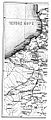 Map of Curuk-su, Adjara and Guria in 1873 (Bakradze, 1878).jpg 470 × 1,107; 171 KB
-

-

-
 Soviet Caucasus map hu.svg 747 × 629; 281 KB
-
 Soviet Caucasus map-es.svg 2,424 × 2,000; 776 KB
-
 Soviet Caucasus map.svg 747 × 629; 731 KB
-
 Soviet caucasus1922.png 1,613 × 1,152; 127 KB
-
 Soviet-caucasus1922.png 1,613 × 1,090; 92 KB
-
 БСЭ1. Аджаристанская АССР.jpg 1,776 × 1,250; 790 KB


.JPG)


.jpg)


-sr.png)

,_X_c.jpg)
,_X_c.jpg)


.jpg)


