Category:Maps of the canton of Ticino to 2010
Jump to navigation
Jump to search
Media in category "Maps of the canton of Ticino to 2010"
The following 23 files are in this category, out of 23 total.
-
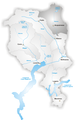
 Karte Kanton Tessin 2010.png 1,771 × 2,196; 1,011 KB
-
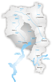
 Karte Kanton Tessin Bezirke 2010.png 1,771 × 2,196; 956 KB
-
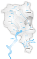
 Karte Kanton Tessin Bezirke 2017.png 1,771 × 2,195; 706 KB
-
 Karte Kanton Tessin.png 767 × 951; 173 KB
-
 Karte Kanton Tessin Bezirke.png 885 × 1,097; 223 KB
-
 Karte Bezirk Bellinzona.png 649 × 1,029; 213 KB
-
 Karte Bezirk Blenio.png 649 × 1,029; 215 KB
-
 Karte Kanton Tessin Cropped.png 535 × 795; 79 KB
-
 Karte Bezirk Leventina.png 649 × 1,029; 214 KB
-
 Karte Bezirk Locarno.png 649 × 1,029; 215 KB
-
 Karte Bezirk Lugano.png 649 × 1,029; 214 KB
-
 Map of Canton Ticino.png 378 × 600; 127 KB
-
 Karte Bezirk Mendrisio.png 649 × 1,029; 211 KB
-
 Karte Bezirk Riviera.png 649 × 1,029; 213 KB
-
 Karte Bezirk Vallemaggia.png 649 × 1,029; 217 KB
-
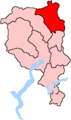
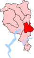 Ti bez bellinzona.png 160 × 270; 4 KB
-
 Ti bez blenio.png 160 × 270; 4 KB
-
 Ti bez leventina.png 160 × 270; 4 KB
-
 Ti bez locarno.png 160 × 270; 4 KB
-
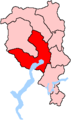
 Ti bez lugano.png 160 × 270; 4 KB
-
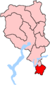 Ti bez mendrisio.png 160 × 270; 4 KB
-
 Ti bez riviera.png 160 × 270; 4 KB
-
 Ti bez vallemaggia.png 160 × 270; 4 KB


