Category:Maps of the Western United States
Jump to navigation
Jump to search
Subcategories
This category has the following 4 subcategories, out of 4 total.
Media in category "Maps of the Western United States"
The following 142 files are in this category, out of 142 total.
-
 US West map.png 1,513 × 983; 65 KB
-
 US West Coast.svg 286 × 186; 137 KB
-

-
 1864 Dower Map of the Western United States - Geographicus - WesternUSA-dower-1864.jpg 2,974 × 3,705; 1.56 MB
-
 Transcontinental railroad route2.png 1,000 × 619; 158 KB
-
 Transcontinental railroad route.png 1,000 × 619; 145 KB
-
 1893 Arid regions of the western united states.jpg 556 × 450; 92 KB
-
 Acer circinatum range map.png 3,200 × 3,200; 93 KB
-
 Acer macrophyllum range map 1.png 4,096 × 4,096; 147 KB
-
 American West map.png 566 × 365; 10 KB
-
 Bia-map-indian-reservations-usa.png 3,124 × 2,200; 457 KB
-
 Big Sky 2012.png 767 × 711; 24 KB
-
 Big Sky Map.svg 959 × 593; 81 KB
-
 BlankMap-USA-Northwest.svg 410 × 386; 37 KB
-
 BlankMap-USA-States-CA-NV-HI.svg 410 × 323; 16 KB
-
 BlankMap-USA-states-west-UT-CA.png 489 × 552; 27 KB
-
 BLM Wilderness Study Areas.jpeg 478 × 600; 61 KB
-
 BPAmap.png 2,266 × 2,518; 7.15 MB
-
 Bulletin of the U.S. Department of Agriculture (1913-1923.) (19879350143).jpg 4,748 × 2,141; 2.51 MB
-
 Bulletin of the U.S. Department of Agriculture (1913-1923.) (20313581729).jpg 4,706 × 2,624; 2.28 MB
-
 Bureau of Reclamation regions.png 1,428 × 1,514; 103 KB
-
 CA floristic province.png 210 × 380; 132 KB
-
 CA-NV-HIdistrictLCMS.jpg 350 × 282; 59 KB
-
 Inland empire within southern california.png 342 × 308; 160 KB
-
 Map of California hightlighting the IE Metro Area.png 203 × 230; 13 KB
-
 Cercocarpus betuloides range map.jpg 641 × 1,042; 225 KB
-
 Colorado Plateaus map-HE.png 324 × 353; 34 KB
-
 Core Distribution of Bull Trout.pdf 2,039 × 1,566; 1.41 MB
-
 Deep Creek Murders Idaho 1896.jpg 626 × 446; 28 KB
-
 Department of the Platte.PNG 386 × 180; 5 KB
-
 Draft Dispersal Map.jpg 1,056 × 816; 656 KB
-
 Early indian west.jpg 1,559 × 2,000; 625 KB
-
 EPA CO-NM snowpack map w text.png 862 × 804; 479 KB
-
 EPA CO-NM snowpack map.png 849 × 698; 411 KB
-
 Ewing Young expeditions.png 963 × 668; 1.31 MB
-
 GB Desert.jpg 864 × 1,152; 936 KB
-
 Great Basin Ecoregions.jpg 683 × 942; 846 KB
-
 Great Basin map.gif 1,074 × 1,200; 342 KB
-
 Greatbasinmap.png 1,500 × 1,676; 7.21 MB
-
 Hobogrove255.png 600 × 579; 55 KB
-
 Indian Lands of Federally Recognized Tribes of the US, June 2016.pdf 7,050 × 4,797; 5.19 MB
-
 Inland Northwest.svg 991 × 1,056; 464 KB
-
 Klamath Mountains location map.jpg 800 × 1,069; 377 KB
-
 Köppen Csc US West Coast.png 4,200 × 7,200; 295 KB
-
 Lewis and Clark National Historic Trail 2015.png 13,200 × 10,200; 975 KB
-
 Lewis and Clark National Historic Trail.PNG 286 × 186; 27 KB
-
 LLWS West 1957-2000.svg 959 × 593; 117 KB
-
 LLWS West.svg 959 × 593; 98 KB
-

-
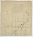
 Map of California and Nevada with parts of Utah and Arizona - NARA - 139309093.jpg 9,672 × 11,561; 10.27 MB
-
 Map of California and Nevada with parts of Utah and Arizona - NARA - 139309095.jpg 9,644 × 12,266; 10.61 MB
-
 Map of California, Nevada, Utah, and Arizona with posts - NARA - 93193224.jpg 7,100 × 6,577; 1.9 MB
-
 Map of Idaho highlighting Magic Valley.png 197 × 300; 23 KB
-
 Map of the American West.jpg 2,932 × 3,476; 2.22 MB
-
-
 Map of the Sioux Country.png 3,073 × 1,921; 3.69 MB
-
 Map of the U.S., highlighting the West.svg 959 × 593; 26 KB
-
 Map of the United States (annotated) - NARA - 122668657 (page 1).jpg 8,812 × 6,279; 4.45 MB
-
 Map of the United States (annotated) - NARA - 122668657 (page 3).jpg 8,808 × 6,241; 3.93 MB
-
-
 Maury Geography 067A Pacific States.jpg 2,019 × 2,500; 1.09 MB
-
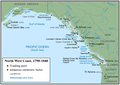 MFT-NorthWestCoast.png 1,215 × 859; 585 KB
-
 Mountainmonograms.jpg 1,958 × 1,950; 1.23 MB
-
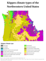 Northwestern US Köppen.png 6,000 × 7,919; 679 KB
-
 Olympicpeninsula.PNG 221 × 136; 3 KB
-
 OregonRegions.svg 6,451 × 4,810; 1.24 MB
-
 OregonsRegions.jpg 800 × 596; 86 KB
-
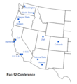 Pac-12 Map.png 497 × 542; 65 KB
-
 PacNWComparison.PNG 230 × 262; 9 KB
-
 PAT - Western United States.gif 1,800 × 2,000; 1.91 MB
-

-
 Public-Lands-Western-US.png 818 × 567; 34 KB
-
 Quercus garryana range map.jpg 511 × 959; 85 KB
-
 See the Best of the West via Union Pacific, 1948.jpg 3,405 × 4,637; 1.68 MB
-
 Temp West map.JPG 885 × 758; 90 KB
-
 The American Indian Fig 102.jpg 1,576 × 2,120; 451 KB
-
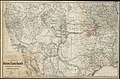
 The conquest of the North of Mexico by Yankees North-Americans.png 1,098 × 551; 405 KB
-
 Transcontinental railroad route-ar.png 1,000 × 619; 378 KB
-
 US map-Mountain states.png 572 × 371; 17 KB
-
 US map-Northwest.PNG 572 × 371; 17 KB
-
 US map-Pacific.PNG 572 × 371; 17 KB
-
 US Mountain West.png 5,912 × 4,003; 1.63 MB
-
 US Pacific States.svg 1,181 × 731; 2.22 MB
-
 US Southwest Temples Outline Map.svg 867 × 578; 10 KB
-
 US west coast physiographic regions map.jpg 221 × 375; 26 KB
-
 USA Region West location map.svg 1,400 × 1,568; 151 KB
-
 USA Region West relief Argus Range location map.jpg 1,867 × 2,091; 1.05 MB
-
 USA Region West relief Bear River Mountains location map.jpg 1,867 × 2,091; 1.05 MB
-
 USA Region West relief Black Mountains location map.jpg 1,867 × 2,091; 1.05 MB
-
 USA Region West relief Bradshaw Mountains location map.jpg 1,867 × 2,091; 1.02 MB
-
 USA Region West relief Chiricahua Mountains location map.jpg 1,867 × 2,091; 1.05 MB
-
 USA Region West relief Chisos Mountains location map.jpg 1,867 × 2,091; 1.05 MB
-
 USA Region West relief Coso Range location map.jpg 1,867 × 2,091; 1.05 MB
-
 USA Region West relief Diablo Range location map.jpg 1,867 × 2,091; 1.05 MB
-
 USA Region West relief Dragoon Mountains location map.jpg 1,867 × 2,091; 1.05 MB
-
 USA Region West relief Elk (Colorado) location map.jpg 1,867 × 2,091; 1.02 MB
-
 USA Region West relief Gabilan Range location map.jpg 1,867 × 2,091; 1.05 MB
-
 USA Region West relief Grand Mesa location map.jpg 1,867 × 2,091; 1.05 MB
-
 USA Region West relief Gros Ventre Range location map.jpg 1,867 × 2,091; 1.05 MB
-
 USA Region West relief Guadalupe Mountains location map.jpg 1,867 × 2,091; 1.05 MB
-
 USA Region West relief House Range location map.jpg 1,867 × 2,091; 1.02 MB
-
 USA Region West relief Klamath Mountains location map.jpg 1,867 × 2,091; 1.05 MB
-
 USA Region West relief location Bitterroot Range map.jpg 1,867 × 2,091; 1.02 MB
-
 USA Region West relief location Clearwater Mountains map.jpg 1,867 × 2,091; 1.03 MB
-
 USA Region West relief location map Capitan Mountains.jpg 1,867 × 2,091; 1.02 MB
-
 USA Region West relief location map Davis Mountains.jpg 1,867 × 2,091; 1.02 MB
-
 USA Region West relief location map Sierra Blanca.jpg 1,867 × 2,091; 1.02 MB
-
 USA Region West relief location map.jpg 1,867 × 2,091; 1.4 MB
-
 USA Region West relief Lost River Range location map.jpg 1,867 × 2,091; 1.05 MB
-
 USA Region West relief Marble Mountains location map.jpg 1,867 × 2,091; 1.05 MB
-
 USA Region West relief Mayacamas Mountains location map.jpg 1,867 × 2,091; 1.05 MB
-
 USA Region West relief Northern Oregon Coast Range location map.jpg 1,867 × 2,091; 1.05 MB
-
 USA Region West relief Oregon Coast Range location map.jpg 1,867 × 2,091; 1.05 MB
-
 USA Region West relief Panamint Range location map.jpg 1,867 × 2,091; 1.05 MB
-
 USA Region West relief Pinaleno Mountains.jpg 1,867 × 2,091; 1.02 MB
-
 USA Region West relief Pryor Mountains location map.jpg 1,867 × 2,091; 1.05 MB
-
 USA Region West relief Rincon Mountains location map.jpg 1,867 × 2,091; 1.05 MB
-
 USA Region West relief San Andres Mountains location map.jpg 1,867 × 2,091; 1.05 MB
-
 USA Region West relief Sandia Mountains location map.jpg 1,867 × 2,091; 1.05 MB
-
 USA Region West relief Sangre de Cristo Range location map.jpg 1,867 × 2,091; 1.05 MB
-
 USA Region West relief Santa Catalina Mountains location map.jpg 1,867 × 2,091; 1.05 MB
-
 USA Region West relief Santa Cruz Mountains location map.jpg 1,867 × 2,091; 1.05 MB
-
 USA Region West relief Santa Lucia Range location map.jpg 1,867 × 2,091; 1.05 MB
-
 USA Region West relief Sawatch Range location map.jpg 1,867 × 2,091; 1.05 MB
-
 USA Region West relief Sawtooth Range location map.jpg 1,867 × 2,091; 1.05 MB
-
 USA Region West relief Siskiyou Mountains location map.jpg 1,867 × 2,091; 1.05 MB
-
 USA Region West relief Superstition Mountains location map.jpg 1,867 × 2,091; 1.05 MB
-
 USA Region West relief Teton Range location map.jpg 1,867 × 2,091; 1.05 MB
-
 USA Region West relief Trinity Mountains location map.jpg 1,867 × 2,091; 1.02 MB
-
 USA Region West relief Tucson Mountains location map.jpg 1,867 × 2,091; 1.05 MB
-
 USA Region West relief Wallowa Mountains location map.jpg 1,867 × 2,091; 1.05 MB
-
 USA Region West relief Wasatch Range location map.jpg 1,867 × 2,091; 1.05 MB
-
 USA Region West relief White Cloud Mountains location map.jpg 1,867 × 2,091; 1.05 MB
-
 Map of USA highlighting West.png 959 × 593; 115 KB
-
 US map-West.png 566 × 365; 20 KB
-
 West Region (WFTDA).png 1,513 × 983; 64 KB
-
 Western united states 1882 map.jpg 674 × 778; 219 KB
-
 Western United States 1882.png 681 × 782; 1.31 MB
-
 Western United States counties, blank.svg 600 × 627; 620 KB
-
 Wpdms nasa topo oregon trail1.jpg 500 × 310; 46 KB
-
 Wpdms nasa topo wind river range.jpg 335 × 280; 30 KB
-
 WRCAI-map.gif 456 × 344; 28 KB


.jpg)


_(19879350143).jpg)
_(20313581729).jpg)


_-_NARA_-_122668657_(page_1).jpg)
_-_NARA_-_122668657_(page_3).jpg)
.jpg)


_location_map.jpg)


.png)


