Category:Maps of the Western Alps
Jump to navigation
Jump to search
Media in category "Maps of the Western Alps"
The following 31 files are in this category, out of 31 total.
-

-
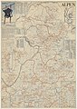
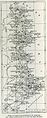 Alpes Françaises.jpg 579 × 1,454; 337 KB
-
 Appenzeller Alpen.png 2,265 × 2,004; 1.98 MB
-
 Berner Alpen.png 2,999 × 2,007; 2.35 MB
-
-
 Emmentaler Alpen.png 3,758 × 3,784; 3.26 MB
-
 Glarner Alpen Map.png 4,984 × 3,979; 4.82 MB
-
 Gotthard-Gruppe.png 1,995 × 1,307; 1.08 MB
-
 Karte Adula-Alpen.png 3,295 × 3,757; 2.98 MB
-
 Karte Belledonne-Gruppe.png 3,131 × 3,534; 3.06 MB
-
 Karte Freiburger Alpen.png 4,742 × 3,670; 4.52 MB
-
 Karte Mont-Blanc-Gruppe.png 1,884 × 1,981; 1.8 MB
-
 Karte Tessiner Alpen.png 2,855 × 3,041; 3.21 MB
-
 Leone-Gruppe.png 2,571 × 2,819; 2.48 MB
-
 Les massifs des Préalpes.png 471 × 726; 189 KB
-
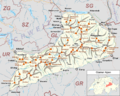
 Massif des Alpes map-fr.svg 730 × 1,088; 1.06 MB
-
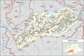
 Massif des Alpes-relief map-fr.svg 800 × 1,192; 4.74 MB
-
 Massifs des Alpes.png 1,024 × 1,519; 612 KB
-
 Massifs des Préalpes map-fr.svg 730 × 1,088; 995 KB
-
 Oestliche Westalpen.svg 2,341 × 2,252; 3.29 MB
-
 Partizione 1926 alpi occidentali.jpg 344 × 411; 59 KB
-
 Schema tettonico delle Alpi.jpg 1,250 × 833; 532 KB
-
 Schwyzer Alpen.png 3,749 × 2,666; 2.98 MB
-
 SchwyzerAlpen.png 1,920 × 1,080; 4.24 MB
-
 Tambogruppe.png 1,732 × 2,457; 2.22 MB
-
 Urner Alpen.png 2,626 × 3,512; 2.65 MB
-
 Val d'Anniviers.png 524 × 826; 622 KB
-
 Walliser Alpen.png 2,412 × 1,733; 2.28 MB
-
 Westalpen-Gebirgsgruppen nach Rochlitz & Bacher 2006.svg 1,190 × 842; 1.53 MB
-
 Western Alps - Regions after Rochlitz & Bacher 2006 blank.svg 641 × 828; 1.27 MB
-
 Westliche Westalpen.png 5,137 × 6,677; 7.98 MB
.jpg)


.jpg)


