Category:Maps of the West Indies Federation
Jump to navigation
Jump to search
| NO WIKIDATA ID FOUND! Search for Maps of the West Indies Federation on Wikidata | |
| Upload media |
Media in category "Maps of the West Indies Federation"
The following 12 files are in this category, out of 12 total.
-
-

-
 1938 Index to Admiralty charts of the West Indies and Central America nla.obj-574968236.jpg 11,160 × 8,238; 17.32 MB
-

-
 CARICOM Map 2010-2 (cropped).png 523 × 360; 35 KB
-
 CARICOM Map 2010-2.png 800 × 406; 46 KB
-
 CARICOM Map 2010.png 800 × 406; 46 KB
-
 Flag map of Jamaica (West Indies Federation).png 2,004 × 779; 32 KB
-
 LocationWHWestIndiesFederation.png 800 × 800; 32 KB
-
 Map of the West Indies Federation.svg 686 × 448; 102 KB
-
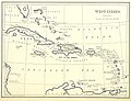
 The Evening Post map of the West Indies.jpg 2,000 × 1,865; 4.92 MB
-
 West Indies Federal elections, 1958 (largest party by island).svg 512 × 443; 292 KB
.jpg)
.jpg)


.png)


.svg)
.png)