Category:Maps of the Ukrainians
Jump to navigation
Jump to search
part of the earth inhabited mainly by Ukrainians  | |||||
| Upload media | |||||
| Instance of |
| ||||
|---|---|---|---|---|---|
| Subclass of | |||||
| Official language | |||||
| |||||
Subcategories
This category has the following 3 subcategories, out of 3 total.
B
R
- Maps of the Ukrainians in Russia (32 F)
Media in category "Maps of the Ukrainians"
The following 35 files are in this category, out of 35 total.
-
 1871 linguistic map of Ukraine - Мапа української мови 1871 (cropped).jpg 2,528 × 1,896; 5.38 MB
-
 1876 Украинцы.PNG 1,670 × 987; 1.12 MB
-
 1897 Ukrainians.png 1,558 × 942; 967 KB
-
 1897 Укр повіти.png 3,511 × 2,849; 4.12 MB
-
 A part of the ethnographic map by Rittikh, 1875.svg 1,672 × 975; 2.18 MB
-
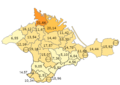
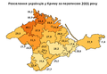
 CrimeaUkrainians1926.PNG 825 × 620; 65 KB
-
 Ethnic-Ukrainians.jpg 3,000 × 1,708; 987 KB
-
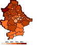
 Ethnicukrainian2001.PNG 1,063 × 877; 106 KB
-
 Ethnographic Map of Ukraine.png 3,460 × 2,096; 1.58 MB
-
 Ethnographische Übersichtkarte der Ukraina.jpg 947 × 554; 288 KB
-
 Ethnographische Übersichtskarte des ukrainischen Nationalterritoriums (1910).jpg 7,635 × 4,367; 5.2 MB
-
 Language key - Мапа української мови 1871 (cropped).jpg 1,194 × 896; 988 KB
-
 Map of Northwestern Ukraine, Korduba, 1917.jpg 994 × 1,394; 1.34 MB
-
 Map of Ukraine, 1918 - Crimea.png 1,338 × 903; 2.46 MB
-
 Map of Ukraine, 1918 - Kurshchyna.png 1,341 × 908; 2.78 MB
-
 Map of Ukraine, 1918 - Voronizhchyna.png 1,489 × 1,359; 4.45 MB
-
 Map of Ukraine, 1918.png 7,013 × 4,922; 74.04 MB
-
 Northwestern borders of Ukrainians, Rittikh, 1875.svg 4,050 × 1,550; 821 KB
-
 Ohladovaya karta ukrayinskykh zemel.jpg 8,562 × 5,554; 8.46 MB
-
 Podil Ukrajincu.png 800 × 558; 161 KB
-
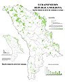 Ponderea ucrainenilor în Republica Moldova la nivel de comune.jpg 4,489 × 5,622; 3.46 MB
-
 Přehledná národopisná mapa Ukrajiny.jpg 1,558 × 1,031; 1.29 MB
-
 Seat of Ukraine Republic.jpg 1,218 × 982; 327 KB
-
 Uk1920.png 2,383 × 1,803; 9.15 MB
-
 Ukraina 1920 (Ugglan).jpg 3,077 × 2,291; 4.17 MB
-
 UkrainerDonezk.png 800 × 600; 220 KB
-
 Ukrainian Canadian population by province.svg 1,114 × 942; 331 KB
-
 Ukrainians in Crimea, 1939.png 667 × 471; 87 KB
-
 Ukrainians2001Crimea.PNG 663 × 461; 28 KB
-
 Державні кольонії України.jpg 1,168 × 1,095; 1.57 MB
-
 Загальна карта України, 1918.jpg 6,797 × 4,196; 9.2 MB
-
 Мапа української мови 1871.jpg 4,080 × 2,984; 9.84 MB
-
 Оглядова карта українських земель, 1915.jpg 2,048 × 1,224; 832 KB
-
 Польська карта народо-населення Центральної Європи 1927 року..jpg 600 × 450; 155 KB
-
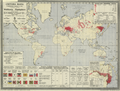
 Світова мапа з розміщенням Українців по світу.jpg 2,953 × 2,276; 6.95 MB
.jpg)


.jpg)
.jpg)


.jpg)


Categories:
- Ukrainians
- Maps of ethnic groups by name
- Maps of ethnic groups in Europe
- Maps of ethnic groups in Ukraine
- Maps of ethnic groups in Moldova
- Maps of ethnic groups in Transnistria
- Maps of ethnic groups in Hungary
- Maps of ethnic groups in Slovakia
- Maps of ethnic groups in Poland
- Maps of the East Slavs
- Maps of Slavic ethnic groups