Category:Maps of the Spratly Islands
Jump to navigation
Jump to search
Wikimedia category | |||||
| Upload media | |||||
| Instance of | |||||
|---|---|---|---|---|---|
| Category combines topics | |||||
| Spratly Islands | |||||
group of reefs, islets, atolls, cays and islands   | |||||
| Instance of |
| ||||
| Location |
| ||||
| Located in or next to body of water | |||||
| Has part(s) |
| ||||
| Elevation above sea level |
| ||||
| Different from | |||||
 | |||||
Pages in category "Maps of the Spratly Islands"
This category contains only the following page.
Media in category "Maps of the Spratly Islands"
The following 50 files are in this category, out of 50 total.
-
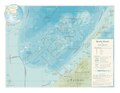
 00-149 Tizard Bank Spratly Islands.png 926 × 595; 72 KB
-
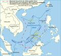
 75967 South-China-Sea-1.jpg 9,570 × 6,660; 30.8 MB
-
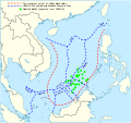
 9 dotted line.png 979 × 1,206; 1.79 MB
-
 China's 2009 nine-dash line map submission to the UN.pdf 1,275 × 1,650; 412 KB
-
 Chinaclaim.png 282 × 277; 7 KB
-
 Corals form the China Sea Bassett-Smith 1890 03.png 5,558 × 3,417; 5.22 MB
-
 DaiNamNhatThongToanDo 1834-1838.jpg 1,146 × 1,623; 890 KB
-
 Features in the Kalayaan Island Group.jpg 14,043 × 9,933; 6.64 MB
-
 GreatWallOfSand.jpg 967 × 770; 177 KB
-
 Kalayaan Island Group (vi).png 800 × 552; 132 KB
-
 Loaita Bank nautical chart of 1911 (cropped).jpg 9,556 × 5,024; 3.18 MB
-
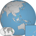
 LocationSpratlyIslands.png 250 × 115; 6 KB
-
 Main features of Malaysian Claim (vi).png 858 × 630; 25 KB
-
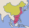
 Malaysia.png 636 × 326; 23 KB
-
 Mantangule Island to Eran Bay (Palawan Passage) NGA Nautical Chart 93046.jpg 21,800 × 15,000; 9.7 MB
-
 Mapspratly.jpg 1,014 × 1,204; 213 KB
-
 North Danger Reef nautical chart of 1911 (cropped).jpg 3,113 × 4,306; 1.05 MB
-
 Pub161-pg1.jpg 996 × 922; 152 KB
-
 Pub161-pgIV.jpg 770 × 950; 108 KB
-
 Scarboroughreef w2 locator.svg 1,000 × 1,000; 227 KB
-
 Schina sea 88.png 979 × 1,206; 1.79 MB
-
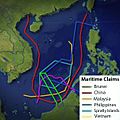
 South China Sea claims 2.png 896 × 1,232; 87 KB
-
 South China Sea claims.jpg 300 × 300; 18 KB
-
 South China Sea vector Chinese.svg 1,004 × 945; 707 KB
-
 South China Sea vector de.svg 764 × 705; 556 KB
-
 South China Sea vector.svg 1,004 × 945; 657 KB
-
 Spratly Is since NalGeoMaps-zh.png 330 × 354; 21 KB
-
 Spratly Is since NalGeoMaps.png 330 × 354; 31 KB
-
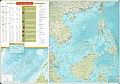
 Spratly Islands in the South China Sea Department of State map 2016587286 (2015).jpg 17,014 × 13,147; 18.37 MB
-
 Spratly Islands in the South China Sea Department of State map 2016587286 (2015).pdf 3,300 × 2,550; 11.15 MB
-
 Spratly Islands partial nautical charts of 1911.jpg 11,776 × 16,480; 11.87 MB
-
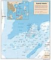
 Spratly Islands-CIA WFB Map.png 330 × 354; 8 KB
-
 Spratly Islands-Vietnamese.PNG 330 × 354; 7 KB
-
 Spratly Islands.PNG 643 × 515; 20 KB
-
 Spratly with flags.jpg 962 × 741; 94 KB
-
 Spratlyislands w1 locator.svg 1,000 × 1,000; 102 KB
-
 Spratlyislands w2 locator.svg 1,000 × 1,000; 224 KB
-
 Thitu Reefs and Subi Reef nautical chart of 1911 (cropped).jpg 6,532 × 4,321; 1.91 MB
-
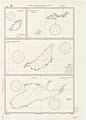
 Tizard Bank nautical chart of 1911 (cropped).jpg 9,559 × 5,312; 3.47 MB
-
 Truong Sa District, Khanh Hoa, Vietnam.svg 2,256 × 1,999; 474 KB
-
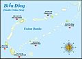
 Union Banks en.svg 720 × 513; 110 KB
-
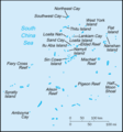
 Union Banks.jpg 720 × 513; 47 KB
-
 Vietnam-1754.jpg 492 × 718; 64 KB
-
 World Factbook (1990) Spratly Islands.jpg 545 × 508; 43 KB
-
 Yongshu Jiao to Po-Lang Chiao NGA Nautical Chart 93047.jpg 22,965 × 16,493; 8.75 MB
-
 Yongshu Jiao to Yongdeng Ansha (South China Sea) NGA Nautical Chart 93044.jpg 23,200 × 16,400; 9.61 MB
-
 中國南海各島嶼圖.jpg 2,568 × 3,589; 4.39 MB
-
 中華民國南沙群島領海基線.jpg 1,472 × 835; 979 KB
-
 南沙群岛2012年形势图.gif 2,596 × 2,186; 464 KB
-
 南沙群岛2012年形势图.png 712 × 600; 143 KB


.png)
.jpg)

.png)

_NGA_Nautical_Chart_93046.jpg)
.jpg)


.jpg)


.jpg)
.jpg)


_Spratly_Islands.jpg)

_NGA_Nautical_Chart_93044.jpg)


