Category:Maps of the Schuylkill River
Jump to navigation
Jump to search
Media in category "Maps of the Schuylkill River"
The following 19 files are in this category, out of 19 total.
-
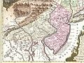 1756 Lotter Map of Eastern Pennsylvania, & New Jersey cropped from Geographicus-1756.jpg 3,600 × 2,700; 4.38 MB
-
 1986-cropped2.jpg 5,083 × 11,431; 17.62 MB
-
 A Plan of the City and Environs of Philadelphia, 1777 WDL9563.png 1,024 × 1,387; 2.64 MB
-

-

-

-

-
 Interpretive wayside for Pottstown Landing.jpg 2,876 × 4,074; 2 MB
-
 Schuylkill river (boat house and water works map).jpeg 206 × 172; 18 KB
-
 Schuylkill river.jpeg 1,107 × 681; 209 KB
-

-
 Schuylkillmap.jpg 434 × 479; 194 KB
-
 Schuylkillmap.png 600 × 603; 163 KB
-
 SchuylkillRiverTrailMap.svg 900 × 900; 2.64 MB
-
 Susquehanna River to Schuylkill River, Chesapeake Bay to Delaware Bay. NYPL484199.tiff 4,991 × 4,117; 58.79 MB
-
 The Schuylkill River National & State Heritage Area LOC 2010588180 (cropped).jpg 3,686 × 3,184; 978 KB
-
 The Schuylkill River National & State Heritage Area LOC 2010588180.jpg 10,232 × 4,783; 5.97 MB
-
 The Schuylkill River National & State Heritage Area LOC 2010588180.tif 10,232 × 4,783; 140.02 MB
-
 Wayside at Pottstown Landing.jpg 3,120 × 4,160; 1.4 MB


.png)

.jpeg)


.jpg)

