Category:Maps of the Sacramento River
Jump to navigation
Jump to search
Media in category "Maps of the Sacramento River"
The following 16 files are in this category, out of 16 total.
-
 Sacramento watershed.png 288 × 307; 39 KB
-
 Sacramentorivermap.jpg 650 × 950; 385 KB
-
 Sacramento Deep Water Ship Channel.png 533 × 800; 1.16 MB
-
 Wpdms usgs photo sacramento delta 2.jpg 700 × 520; 81 KB
-
 Admiralty Chart No 229 Point Pinos to Bodega Head, Published 1868, Large Corrections 1959.jpg 11,274 × 16,460; 59.85 MB
-
 Andrus Island (California).png 817 × 818; 1.18 MB
-

-
-
 California fish and game (20324946488).jpg 1,909 × 2,377; 470 KB
-

-
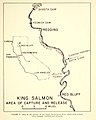
 PSM V61 D214 Salmon monitoring stations along the sacramento river.png 924 × 2,069; 60 KB
-
 Sacmapupdate-01.png 2,500 × 2,500; 2.76 MB
-
 Sacramento and Feather River diazinon improvements.jpg 960 × 1,242; 269 KB
-
 Sacramento River basin map.png 886 × 1,205; 1.44 MB
-
 Sacramento River Flood, California 1904.jpg 718 × 1,218; 206 KB
-
 Sacrivermap1.jpg 1,743 × 2,434; 4.79 MB


.png)
_(14591487048).jpg)
.jpg)
_(page_16_crop).jpg)


_(14591622877).jpg)