Category:Maps of the Republic of China (1912–1949)
Jump to navigation
Jump to search
English: This category is only suitable for the territory owned by the Republic of China in 1912-1949.
日本語: このカテゴリは1912-1949年に中国大陸を領有するにのみ適用されます。
中文(臺灣):這個類別只適用於1912-1949年在中國大陸的期間。
Subcategories
This category has the following 7 subcategories, out of 7 total.
Media in category "Maps of the Republic of China (1912–1949)"
The following 100 files are in this category, out of 100 total.
-
 Menber Constitutional Protection Movement.png 889 × 720; 192 KB
-
 1930 Map of the Republic of China.JPG 1,171 × 817; 272 KB
-
 1935 Guangdong sheng you.png 1,444 × 2,004; 6.48 MB
-
 1935 Guangdong sheng zuo.png 1,444 × 1,948; 6.94 MB
-
 1939 Ouya Zongtu.jpg 3,510 × 2,717; 1.7 MB
-
 1947 Nanhai Zhudao.png 2,654 × 3,840; 4.42 MB
-
 1947 Nanyang Qundao.png 3,057 × 1,975; 13.05 MB
-
 1947 Zhonghua Minguo Quantu.png 3,044 × 2,000; 13.79 MB
-
 1952 Nanhai Zhudao.png 2,031 × 2,898; 11.11 MB
-
 1955 Nanhai Zhudao.png 1,640 × 2,220; 5.4 MB
-
 1958 Nanhai Zhudao.png 2,648 × 3,842; 17.23 MB
-
 77shibian.png 846 × 560; 65 KB
-
 A brief history of Taiwan en.gif 994 × 1,000; 107 KB
-
 Battle of Chishui River.png 1,585 × 1,125; 1.6 MB
-
 Bombing of Chongqing.png 1,120 × 790; 452 KB
-
 Captura de Pantalla 2022-08-27 a las 21.21.27.png 1,002 × 1,008; 1.18 MB
-
 CaudillosMilitaresEnChina1925.svg 1,199 × 922; 1.1 MB
-
 CaudillosMilitaresEnChina1925Alternativo.svg 1,124 × 1,034; 1.17 MB
-
 CCP expand 1934 - 1949.PNG 383 × 395; 13 KB
-
 China blank map (1936).svg 1,000 × 810; 237 KB
-
 China in 1936.svg 1,215 × 940; 1.97 MB
-
 China in 1946.svg 1,215 × 940; 2.11 MB
-
 China old map 1936.jpg 1,067 × 761; 417 KB
-
 China-Manchukuo-map (tr).svg 424 × 302; 313 KB
-
 China-Manchukuo-map mk.svg 424 × 302; 383 KB
-
 China-Manchukuo-map-es.svg 1,262 × 900; 600 KB
-
 China-Manchukuo-map.svg 424 × 302; 281 KB
-
 Chine 1911-1916.png 4,000 × 4,000; 3.29 MB
-
 Chine 1921-1922.png 4,000 × 4,000; 2.7 MB
-
 Chine 1923-1924.png 4,000 × 4,000; 2.62 MB
-
 Chine 1925-1926.png 4,000 × 4,000; 2.66 MB
-
 Chine 1927-1928.png 4,000 × 4,000; 2.62 MB
-
 Chine 1929-1930.png 4,000 × 4,000; 2.6 MB
-
 Chine de 1917 à 1920-zh.png 768 × 768; 347 KB
-
 Chine de 1917 à 1920.png 3,500 × 3,500; 3.2 MB
-
 Chinese civil war map 02.jpg 1,141 × 870; 183 KB
-
 Chongqing, Republic of China.png 1,280 × 1,001; 39 KB
-
 Communist Offensives April-October 1949-es.svg 1,124 × 865; 571 KB
-
 Communist Offensives November 1948-January 1949-es.svg 1,124 × 865; 565 KB
-
 Communist Offensives September through November 1948-es.svg 1,124 × 865; 568 KB
-
 Dairen, Republic of China.png 1,280 × 1,001; 39 KB
-
 Famine map of the 1920-1921 period.png 598 × 628; 777 KB
-
 GuerraDeProtecciónNacional19151916.svg 1,124 × 865; 1.1 MB
-
 Guerre sino-soviétique.png 1,000 × 872; 183 KB
-
 Hankou, Republic of China.png 1,280 × 1,001; 39 KB
-
 Harbin, Republic of China.png 1,280 × 1,001; 39 KB
-
 Japanese Empire - 1942.svg 1,100 × 837; 875 KB
-
 Japanese Empire2.png 1,032 × 1,201; 927 KB
-
 Japanese Occupation - Map.jpg 1,119 × 857; 482 KB
-
 Japanese Occupation 1940 updated.png 776 × 600; 364 KB
-
 Japanese Occupation of China 1940 de.svg 1,119 × 857; 217 KB
-
 Japanese Occupation of China 1940.svg 1,119 × 857; 284 KB
-
 JapanoccupationMengjiang1938.jpg 258 × 201; 50 KB
-
 KMTretreat.PNG 390 × 288; 78 KB
-
 KMTretreat0.png 889 × 739; 39 KB
-
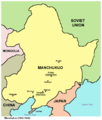 Manchukuo map.png 808 × 953; 52 KB
-
 Map of Asia from the Interwar period, ca. 1932-36.jpg 1,600 × 1,200; 1.32 MB
-
 Map of China (1912-1949).png 836 × 614; 284 KB
-
 Map of Northern Expedition.png 922 × 1,192; 83 KB
-

-
 Map of Tibet detail from China old map 1936 (cropped).jpg 504 × 391; 115 KB
-
 Missions catholiques en Chine.jpg 18,729 × 14,291; 59.34 MB
-
 National Protection War map zh-tw.svg 512 × 394; 658 KB
-
 Nationalist China 1929 - 1937.PNG 888 × 688; 183 KB
-
 Occupation of Outer Mongolia and Tannu Uriankhai.svg 538 × 536; 600 KB
-
 OcupaciónJaponesaDeChina1940.svg 1,124 × 865; 1.05 MB
-
 Pieni 1 0017.jpg 3,443 × 2,552; 2.28 MB
-
 Postal map of China - btv1b53209800w.jpg 20,070 × 20,917; 55.39 MB
-
 PRGROC.JPG 813 × 1,004; 143 KB
-
 Proposed Operation 5.png 1,119 × 790; 712 KB
-
 Republic of China (orthographic projection).svg 512 × 512; 3.22 MB
-
 Republic of China (orthographic projection, historical).svg 538 × 536; 525 KB
-
 Republic of China poster.png 5,000 × 3,520; 622 KB
-
 RevoluciónDeXinhai1911.svg 1,124 × 865; 843 KB
-
 ROC 1949.JPG 777 × 541; 45 KB
-
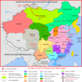
 ROC Administrative Subdivisions vi.png 8,332 × 6,586; 6.31 MB
-
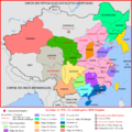
 ROC Administrative Subdivisions zh-hant.svg 677 × 535; 306 KB
-
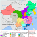
 ROC Claims blank.svg 677 × 535; 492 KB
-
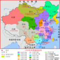
 ROC CY.svg 677 × 535; 370 KB
-
 ROC Geo Regions Text.png 781 × 650; 118 KB
-
 ROC map sculpture with Penghu Wenshi 20190811.jpg 2,432 × 3,648; 3.59 MB
-
 ROC-Timezones (zh TW).svg 735 × 585; 238 KB
-
 ROC-TimeZones (zh).png 799 × 587; 482 KB
-
 ROC-TimeZones.png 830 × 610; 315 KB
-
 ROC-Timezones.svg 735 × 585; 130 KB
-
 ROC-TimeZones.svg 735 × 585; 343 KB
-
 Russian Map of the Republic of China.png 836 × 614; 186 KB
-
 RutasDeAbastecimientoDelGobiernoDeChongqing.svg 1,125 × 897; 1.03 MB
-
 Second Sino-Japanese War WW2.png 776 × 600; 362 KB
-
 Seigneurs de la guerre - 1925.png 1,123 × 1,033; 484 KB
-
 Sian, Republic of China.png 1,280 × 1,001; 39 KB
-
 TerritoriosDeLaCamarilladeAnhui1917.svg 1,123 × 910; 1.04 MB
-
 The first proposals for the division of Japan - WW2.png 4,470 × 3,510; 724 KB
-
 The Hump and Burma Road.png 1,120 × 796; 343 KB
-
 Theaters of Chinese National Revolutionary Army.png 2,480 × 3,508; 672 KB
-
 Xiapu (1739-1935).jpg 800 × 555; 99 KB
-
 Zhejiang ROC.jpg 391 × 346; 15 KB
-
 护国战争.svg 1,124 × 865; 583 KB
-
 新宁铁路路线图.jpg 1,441 × 1,610; 160 KB
-
 華北五省自治示意圖.jpg 565 × 810; 128 KB


.svg)


.png)

.JPG)
.jpg)


.svg)
.svg)


.svg)
.png)


.jpg)


.svg)