Category:Maps of the Palmer Archipelago
Jump to navigation
Jump to search
Subcategories
This category has only the following subcategory.
M
- Maps of the Melchior Islands (22 F)
Media in category "Maps of the Palmer Archipelago"
The following 25 files are in this category, out of 25 total.
-
 Anvers Island, Palmer Archipelago, BAT.svg 522 × 514; 3.53 MB
-
 Brabant Island, Palmer Archipelago, BAT.svg 522 × 514; 3.53 MB
-
 Davis Island ringed, Palmer Archipelago, BAT.svg 522 × 514; 3.53 MB
-
 Davis Island, Palmer Archipelago, BAT.svg 522 × 514; 3.53 MB
-
 Doumer Island, Palmer Archipelago, BAT.svg 522 × 514; 3.53 MB
-
 Gand Island, Palmer Archipelago, BAT.svg 522 × 514; 3.53 MB
-
 Goudier Island, Palmer Archipelago, BAT.svg 522 × 514; 3.53 MB
-
 Hoseason Island, Palmer Archipelago, BAT.svg 522 × 514; 3.53 MB
-
 Hunt Island ringed, Palmer Archipelago, BAT.svg 522 × 514; 3.53 MB
-
 Hunt Island, Palmer Archipelago, BAT.svg 522 × 514; 3.53 MB
-
 Intercurrence Island, Palmer Archipelago, BAT.svg 522 × 514; 3.53 MB
-
 Lecointe Island, Palmer Archipelago, BAT.svg 522 × 514; 3.53 MB
-
 Lion Island ringed, Palmer Archipelago, BAT.svg 522 × 514; 3.53 MB
-
 Lion Island, Palmer Archipelago, BAT.svg 522 × 514; 3.53 MB
-
 Liège Island, Palmer Archipelago, BAT.svg 522 × 514; 3.53 MB
-
 Melchior Islands ringed, Palmer Archipelago, BAT.svg 522 × 502; 3.53 MB
-
 Melchior Islands, Palmer Archipelago, BAT.svg 522 × 502; 3.53 MB
-
 Palmer Archipelago location in Graham Land, BAT.svg 1,282 × 1,662; 3.99 MB
-
 Palmer Archipelago, British Antarctic Territory.svg 522 × 502; 3.84 MB
-
 Spert Island ringed, Palmer Archipelago, BAT.svg 522 × 514; 3.53 MB
-
 Spert Island, Palmer Archipelago, BAT.svg 522 × 514; 3.53 MB
-
 Tower Island, Palmer Archipelago, BAT.svg 522 × 514; 3.53 MB
-
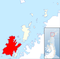
 Trinity Island, Palmer Archipelago, BAT.svg 522 × 514; 3.53 MB
-
 Two Hummock Island, Palmer Archipelago, BAT.svg 522 × 514; 3.53 MB
-
 Wiencke Island, Palmer Archipelago, BAT.svg 522 × 514; 3.53 MB


