Category:Maps of the Orinoco watercourse system
Jump to navigation
Jump to search
Subcategories
This category has the following 3 subcategories, out of 3 total.
!
M
- Maps of Orinoco River (41 F)
- Maps of the Orinoco basin (12 F)
Media in category "Maps of the Orinoco watercourse system"
The following 15 files are in this category, out of 15 total.
-
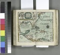 A chart of the West Indias from Cap Cod to ye River Oronoque - by John Seller. NYPL433739.tiff 4,732 × 4,283; 58.01 MB
-
 Alexander von Humboldt (1769-1859) Baron Wellcome L0031820.jpg 1,808 × 1,116; 851 KB
-
 Canal do Cassiquiare.jpg 1,308 × 2,011; 297 KB
-
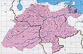
 Cuenca del Apure.jpg 2,097 × 1,378; 684 KB
-
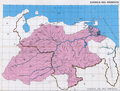
 Cuenca del Orinoco 2.JPG 1,821 × 1,190; 458 KB
-
 Cuenca del Orinoco.jpg 1,821 × 1,190; 713 KB
-
 Cuenca del Orinoco.png 1,018 × 773; 1.59 MB
-
 Cuenca Orinoco.png 940 × 738; 396 KB
-
 English guiana guayana inglesa y Venezuela en 1831.jpg 618 × 461; 59 KB
-
-
 Guaviarerivermap.png 981 × 984; 164 KB
-
-
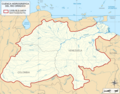
 Orinoco drainage basin map (plain)-es.svg 1,880 × 1,476; 466 KB
-
 Orinoco drainage basin map (zones)-es.svg 1,880 × 1,476; 472 KB
-
 Orinoco drainage basin map-es.svg 1,880 × 1,476; 1,003 KB
_Baron_Wellcome_L0031820.jpg)


-es.svg)
-es.svg)
