Category:Maps of the Organization of American States
Jump to navigation
Jump to search
Media in category "Maps of the Organization of American States"
The following 17 files are in this category, out of 17 total.
-
 Aguas territoriales OEA.svg 800 × 400; 695 KB
-
 Continental organizations.svg 2,754 × 1,398; 1.17 MB
-
 Cuba and the Organization of American States.svg 536 × 536; 435 KB
-
 InterAmTortureConvMap.gif 427 × 625; 7 KB
-
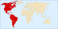 LocationOAS.svg 1,000 × 500; 2.53 MB
-
 Mapoeaestados miembros.png 384 × 387; 39 KB
-
 OAS map.png 478 × 626; 16 KB
-
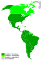
 OAS membership map.svg 384 × 387; 634 KB
-
 OAS Observer.png 1,357 × 628; 39 KB
-
 OASmap 2005.png 430 × 628; 6 KB
-
 OEA OAS Map.PNG 1,357 × 628; 45 KB
-
 OEA.svg 384 × 387; 577 KB
-

-
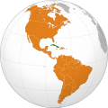
 Organization of American States (orthographic projection).svg 536 × 536; 435 KB
-
 Pacto de Bogotá países.svg 280 × 403; 520 KB
-
 Rio Pact (orthographic projection).svg 550 × 550; 1.09 MB
-
 大陆组织地图.png 1,357 × 628; 81 KB


_-_disputed_version.svg)
.svg)

.svg)
