Category:Maps of the Oranje Drainage basin
Jump to navigation
Jump to search
Subcategories
This category has the following 2 subcategories, out of 2 total.
O
- Maps of Orange River (11 F)
V
- Maps of Vaal River (8 F)
Media in category "Maps of the Oranje Drainage basin"
The following 9 files are in this category, out of 9 total.
-
 Fish River Basin OSM.png 3,539 × 5,011; 18.59 MB
-
 Koppen-Geiger Oranje Basin.png 2,040 × 1,298; 647 KB
-
 Molopo Basin OSM.png 7,183 × 6,202; 38.72 MB
-
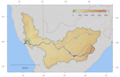
 Orange watershed plain.png 1,150 × 741; 116 KB
-
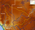
 Orange watershed topo.png 1,150 × 741; 556 KB
-
 Orange River basin map.svg 746 × 533; 2.9 MB
-
 Oranje River Basin OSM.png 8,805 × 7,709; 74.49 MB
-
 Vaal Basin OSM.png 5,256 × 4,135; 25.62 MB
-
 Vaal River Route (he).png 1,006 × 649; 569 KB


.png)