Category:Maps of the Negev
Jump to navigation
Jump to search
Subcategories
This category has only the following subcategory.
Media in category "Maps of the Negev"
The following 29 files are in this category, out of 29 total.
-
 MACCOUN(1899) p059 DESERT OF THE WANDERINGS, THE NEGEB OR SOUTH COUNTRY.jpg 3,590 × 1,968; 2.93 MB
-
 A dictionary of the Bible.. (1887) (14595226549).jpg 2,020 × 3,284; 970 KB
-
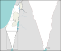
 Al 'Awja Neutral Zone.jpg 494 × 885; 394 KB
-
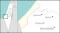
 Beersheba Israel Map.png 285 × 275; 10 KB
-
 GazaWestNegev.svg 2,100 × 1,360; 99 KB
-
 Gerar.jpg 962 × 855; 136 KB
-
 Hanegev o.png 1,448 × 2,053; 630 KB
-
 Hans Fischer, Das Syrisch - Aegyptische Grenzgebiet (FL10423010 2367090) (cropped3).jpg 4,099 × 2,511; 18.97 MB
-
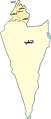
 Israel outline negev mt.png 1,398 × 1,168; 177 KB
-
 Israel outline north negev.png 1,471 × 715; 135 KB
-
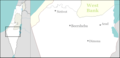
 Israel outline northwest negev.png 844 × 471; 68 KB
-
 Israel outline southern negev mt.png 1,398 × 1,168; 45 KB
-
 Localització dels Alts d'Hobab.png 300 × 200; 8 KB
-
 Map-arava.jpg 534 × 793; 217 KB
-
 Naqab map.jpg 300 × 701; 27 KB
-

-
 Palestine map with Negev bold.svg 403 × 748; 243 KB
-
 Palmer map of Northern Sinai and the Negev.jpg 2,523 × 2,450; 948 KB
-
 PikiWiki Israel 4511 Nevatim in the Negev.JPG 1,024 × 768; 219 KB
-

-
 Schetsen, woestijnen, negev, Israël, Bestanddeelnr 254-6114.jpg 2,623 × 1,935; 499 KB
-
 Stamp of Israel - Negev.jpg 487 × 717; 211 KB
-

-
 WV Arabah region in Israel.png 613 × 1,140; 84 KB
-

-
 עמק ססגון ממוקד.png 732 × 375; 293 KB
-
 עמק ססגון.png 1,007 × 644; 740 KB
-
 ערך ויקיפדיה.png 210 × 139; 10 KB
-
 צוקי עובדה.png 208 × 137; 10 KB
_p059_DESERT_OF_THE_WANDERINGS,_THE_NEGEB_OR_SOUTH_COUNTRY.jpg)
_(14595226549).jpg)


_(cropped3).jpg)


_(14804465753).jpg)


.jpg)


