Category:Maps of the Moselle River
Jump to navigation
Jump to search
Media in category "Maps of the Moselle River"
The following 50 files are in this category, out of 50 total.
-
 2006-08-12 Cochemer Krampen.png 1,128 × 1,374; 66 KB
-

-
 Bassin de la Moselle.png 569 × 655; 602 KB
-
 Cochem (Karte des Deutschen Reiches, 504. Cochem) - urn-nbn-de-0128-1-12751.jpg 5,640 × 4,437; 6.41 MB
-
 Contours du Toulois selon différentes époques.jpg 729 × 692; 81 KB
-
 Der Rhein, die Maass und Mosel.jpg 6,641 × 7,912; 20.33 MB
-
 Dietrich 1910 Abb 2 Alte Flussläufe Ausschnitt en.jpg 1,427 × 879; 521 KB
-
 Dietrich 1910 Abb 2 Alte Flussläufe Ausschnitt.jpg 1,427 × 879; 529 KB
-
 Dietrich 1910 Abb 2 Alte Flussläufe.jpg 2,179 × 2,092; 679 KB
-
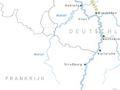
 Flusssystemkarte Mosel(Rhein 03Wwasser).png 763 × 1,188; 2.2 MB
-
 Karte der Moselstaustufen.png 1,480 × 2,689; 284 KB
-
 La Boucle de la Moselle.png 1,753 × 1,240; 681 KB
-
 LASB K Hellwig 0088.jpg 9,189 × 6,887; 8.09 MB
-
 LASB K Hellwig 0089.jpg 9,424 × 6,986; 7.66 MB
-
 LASB K Hellwig 0096.jpg 6,786 × 6,102; 8.25 MB
-
 LASB K Hellwig 0116.jpg 7,425 × 6,399; 16.95 MB
-
 LASB K Hellwig 0117.jpg 7,209 × 6,282; 14.29 MB
-
 LASB K Hellwig 0118.jpg 7,944 × 6,924; 13.46 MB
-
 LASB K Hellwig 0119.jpg 7,227 × 6,396; 16.17 MB
-
 LASB K Hellwig 0126.jpg 6,985 × 4,062; 4.21 MB
-
 LASB K Hellwig 0128.jpg 7,101 × 4,005; 4.09 MB
-
 LASB K Hellwig 0129.jpg 7,000 × 4,095; 4.33 MB
-
 LASB K Hellwig 0143.jpg 4,608 × 5,499; 5.08 MB
-
 LASB K Hellwig 0271.jpg 7,680 × 6,529; 14.45 MB
-
 LASB K Hellwig 0272.jpg 7,670 × 6,340; 15.2 MB
-
 LASB K Hellwig 0281.jpg 7,406 × 11,354; 7.83 MB
-
 LASB K Hellwig 0285.jpg 6,357 × 7,584; 13.78 MB
-
 LASB K Hellwig 0293.jpg 9,648 × 6,420; 21.92 MB
-
 LASB K Hellwig 0737.jpg 3,632 × 2,616; 1.42 MB
-
 LASB K Hellwig 0741.jpg 3,370 × 2,435; 884 KB
-
 LASB K Hellwig 0742.jpg 5,013 × 3,420; 3.38 MB
-
 LASB K Hellwig 0902.jpg 4,781 × 3,545; 29.42 MB
-
 LASB K Hellwig 0907.jpg 4,263 × 3,331; 26.3 MB
-
 LocatieMoezel.png 597 × 447; 36 KB
-
 MapMoselle.jpg 668 × 600; 449 KB
-
 Metz bis coblenz.jpg 2,000 × 1,354; 257 KB
-
 Mosel 3.jpg 1,000 × 3,242; 701 KB
-
 Mosel Einzugsgebiet.png 900 × 1,440; 2.11 MB
-
 Mosel Metz bis Koblenz 1.jpg 451 × 1,472; 109 KB
-
 Mosel-Weinbau-Karte für den Regierungsbezirk Coblenz , 1897 - urn-nbn-de-0128-1-3517.jpg 7,389 × 4,748; 3.85 MB
-
 Moselkarte.png 597 × 447; 51 KB
-
 Moselle watershed.png 1,070 × 887; 1.22 MB
-
 Navirhin 1202854.JPG 2,206 × 3,756; 1.93 MB
-
 Opera Momentaufnahme 2019-07-14 103829 www.stadtplan.de Moselquelle.png 1,327 × 509; 114 KB
-
 Perl1730.jpeg 800 × 537; 114 KB
-
 Roscheiderhof-Karte-1820.jpg 1,684 × 1,716; 2.9 MB
-

-
 Schleicherberg projekt PIANC.jpg 514 × 614; 38 KB
-
 Verlaufskarte Mosel.png 1,715 × 2,938; 9.06 MB
-
 Zeltinger Landwehr Ortslage.jpg 748 × 641; 92 KB

.jpg)

_-_urn-nbn-de-0128-1-12751.jpg)


.png)


