Category:Maps of the Malay Peninsula
Jump to navigation
Jump to search
Subcategories
This category has the following 3 subcategories, out of 3 total.
M
- Maps of the Kra Canal (2 F)
S
Media in category "Maps of the Malay Peninsula"
The following 21 files are in this category, out of 21 total.
-

-

-

-
 The Harmsworth atlas and Gazetter 1908 (135850297).jpg 12,558 × 9,576; 119.48 MB
-
 32 of 'The Peoples and Politics of the Far East, etc' (11233803486).jpg 2,320 × 1,488; 701 KB
-
 33 of 'The Peoples and Politics of the Far East, etc' (11233315554).jpg 2,304 × 1,556; 699 KB
-

-

-
 Gulf of Thailand ja.png 303 × 389; 7 KB
-
 Hessel Gerritsz, Map of Sumatra showing Pedra Branca (1620).jpg 497 × 628; 105 KB
-
 Indochinese Peninsula ja.png 463 × 655; 12 KB
-
 Kukenthal journey.jpg 3,180 × 1,980; 3.13 MB
-
 LocationMalayPeninsula.png 250 × 115; 5 KB
-
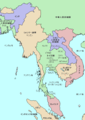
 MalaysiaThai.svg 860 × 1,300; 564 KB
-

-
 Paganracesofmala01skea 0446.jpg 1,625 × 2,126; 269 KB
-
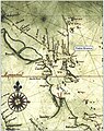
 PedraBranca-MapofDominionsofJohore-Hamilton-1727.jpg 466 × 575; 75 KB
-
 PedraBranca-MapofMalaya-1925.jpg 621 × 458; 90 KB
-
 Relief map of the Malay Peninsula and Gulf of Thailand.png 482 × 413; 144 KB
-
 Semenanjung Malaka.png 1,070 × 1,565; 408 KB
-
 Thai channel plans.jpg 892 × 855; 103 KB


.jpg)
.jpg)
.jpg)
.jpg)
.jpg)


.jpg)


_by_James_Low.jpg)


