Category:Maps of the London Borough of Redbridge
Jump to navigation
Jump to search
Media in category "Maps of the London Borough of Redbridge"
The following 9 files are in this category, out of 9 total.
-
 Barking CP Ward Map 1871.svg 595 × 1,045; 121 KB
-
 ELondon.PNG 254 × 368; 11 KB
-
 Ilford essex 1961.png 1,200 × 943; 44 KB
-
 LondonRedbridge.svg 962 × 744; 19 KB
-
 Redbridge London blank ward map 2018.svg 512 × 512; 205 KB
-
 Redbridge London UK blank ward map.svg 1,267 × 1,266; 449 KB
-
 Redbridge London UK labelled ward map 2002.svg 1,161 × 1,231; 105 KB
-
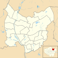
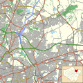 Redbridge London UK location map.svg 1,267 × 1,266; 3.72 MB
-
 Wanstead and woodford essex 1961.png 1,200 × 943; 44 KB


