Category:Maps of the Kalmar Union
Jump to navigation
Jump to search
Media in category "Maps of the Kalmar Union"
The following 10 files are in this category, out of 10 total.
-
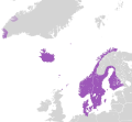
 Flag map of the Kalmar Union (Mainland).png 471 × 624; 55 KB
-
 Kalmar Union c. 1500-de.svg 590 × 685; 285 KB
-
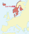 Kalmar Union c. 1500-ja.svg 590 × 685; 400 KB
-
 Kalmar Union c. 1500.svg 590 × 685; 399 KB
-
 Kalmar Union ca. 1400.svg 499 × 463; 277 KB
-
 Kalmarunionen.png 540 × 238; 70 KB
-
 Södra sverige och danmark under unionstiden med stockholm.jpg 1,524 × 1,824; 1.03 MB
-
 The Kalmar Union at the beginning of the 16 Century.PNG 949 × 926; 47 KB
-
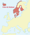 Unio de Kalmar.svg 590 × 685; 398 KB
-
 Union of Kalmar (1500).svg 450 × 500; 390 KB
.png)


.svg)