Category:Maps of the Irtysh River
Jump to navigation
Jump to search
Media in category "Maps of the Irtysh River"
The following 14 files are in this category, out of 14 total.
-
 Irtysh basin-bg.PNG 975 × 768; 79 KB
-
 Irtysh basin.png 975 × 768; 67 KB
-
 Irtysh river basin map.png 1,022 × 1,162; 1.77 MB
-
 Irtyshrivermap.jpg 828 × 704; 292 KB
-
 Ob watershed ru.png 300 × 300; 46 KB
-
 Ob watershed.png 988 × 988; 295 KB
-
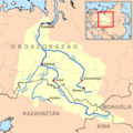
 Irtysh-Karaganda.PNG 1,464 × 1,673; 66 KB
-

-

-
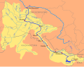 Irtysh basin hu.svg 1,300 × 1,024; 100 KB
-
 Ob watershed hu.png 800 × 800; 323 KB
-
 Russian Empire 1745 (Map XV HQ).jpg 9,099 × 8,326; 10.64 MB
-
 Russian Empire 1745 (Map XV in Latin).jpg 7,480 × 6,851; 16.94 MB
-
 Russian Empire 1745 (Map XV).jpg 2,172 × 1,920; 2.81 MB


.jpg)


.jpg)
.jpg)
.jpg)