Category:Maps of the Hittite Empire
Jump to navigation
Jump to search
| NO WIKIDATA ID FOUND! Search for Maps of the Hittite Empire on Wikidata | |
| Upload media |
Subcategories
This category has the following 12 subcategories, out of 12 total.
1
M
- Maps of Hattusa (13 F)
- Maps of the Battle of Kadesh (15 F)
Media in category "Maps of the Hittite Empire"
The following 44 files are in this category, out of 44 total.
-
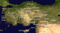 Anatolia città Impero Ittita.png 814 × 449; 650 KB
-
 Anatolie hittite-de.svg 1,375 × 779; 1.97 MB
-
 Anatolie hittite-es.svg 1,375 × 779; 2 MB
-
 Anatolie hittite-pt.svg 1,375 × 779; 2 MB
-
 Anatolie hittite.svg 1,375 × 779; 2 MB
-
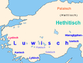 Anatolisch.png 578 × 443; 34 KB
-
 Anatólia a hettita időkben.png 2,000 × 947; 2.57 MB
-
 Ancient Caucasoid Horizon.jpg 651 × 317; 35 KB
-
 Early Hittite Kingdom.png 1,375 × 779; 1.91 MB
-
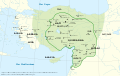
 Empire of the Hitties.png 2,373 × 1,469; 3.21 MB
-
 Hayasa.tif 600 × 381; 670 KB
-
 Hayasaa.jpg 400 × 262; 56 KB
-
 Hethiter.svg 1,605 × 987; 1.91 MB
-
 Hettita birodalom.png 2,000 × 947; 2.36 MB
-
 Hettita első átmenet.png 1,270 × 873; 1.35 MB
-
 Hititen erreinua Shubiluliuma I.aren garaian.svg 1,890 × 1,194; 400 KB
-
 Hitt Egypt Perseus.png 850 × 850; 311 KB
-
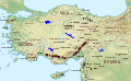
 Hittite Empire ua.PNG 807 × 693; 48 KB
-
 Hittite kingdom Bul Map.png 5,189 × 4,200; 592 KB
-
 Hittite Kingdom.png 1,500 × 996; 211 KB
-
 Hittite KingdomsecXIV.png 800 × 531; 290 KB
-
 Hittite-Luwian Global25Results.png 2,281 × 1,445; 1.08 MB
-
 Hittites.png 1,863 × 1,440; 2.61 MB
-
-
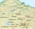 KarumKanis.svg 576 × 476; 1.94 MB
-
 Korahettita időszak térképe.png 2,000 × 947; 2.14 MB
-
 Kultorte.png 474 × 422; 228 KB
-
 Land of Pala.jpg 1,280 × 585; 559 KB
-
 Ludy Morza (Sea Peoples).jpg 3,273 × 2,024; 705 KB
-
 Map Hittite rule (Indonesian version).svg 1,890 × 1,194; 401 KB
-
 Map Hittite rule en.svg 1,890 × 1,194; 427 KB
-
 Map Hittite rule es.svg 1,890 × 1,194; 402 KB
-
 Map Hittite rule pt.svg 1,890 × 1,194; 401 KB
-
 Map of Mari + Ugarit.jpg 5,452 × 4,200; 10.64 MB
-
 Mapa 1600AC.png 3,170 × 2,406; 5.66 MB
-
 Mapa Hittites cat.png 1,024 × 647; 210 KB
-
 Mapaderienteproximo.svg 1,115 × 865; 11.13 MB
-
 Mapaderienteproximosinrelieve.svg 1,115 × 865; 8.74 MB
-
 Meskalams Plan of Karabel After Bittel 1939 Fig2 p184.svg 408 × 662; 274 KB
-
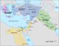
 Moyen Orient Amarna 1.svg 1,885 × 1,354; 4.02 MB
-
 Pahhuwa.jpg 1,280 × 585; 561 KB
-
 Sites hittites.svg 1,375 × 779; 2 MB
-
 Starověký-Blízký-východ.png 1,112 × 763; 607 KB
-
 Tarhuntassa.svg 749 × 561; 553 KB


.jpg)
.svg)


