Category:Maps of the Heruli
Jump to navigation
Jump to search
Media in category "Maps of the Heruli"
The following 17 files are in this category, out of 17 total.
-
 Central Europe 5th Century.jpg 1,088 × 763; 457 KB
-
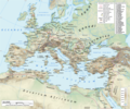
 Europe and the Near East at 476 AD.png 2,830 × 1,967; 1.58 MB
-
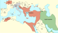
 Huns450.png 719 × 697; 185 KB
-
 Huns450es.svg 3,202 × 2,535; 1.06 MB
-
 IMPERIUL ROMAN IN 125.svg 2,380 × 1,884; 5.01 MB
-
 Kattegat1germaanlased.gif 461 × 294; 39 KB
-
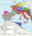
 Kmene v Podunají.png 982 × 642; 688 KB
-
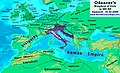 Odoacer 480ad.jpg 900 × 545; 701 KB
-
 Roman Empire 125 general map-zh.png 2,732 × 2,271; 6.07 MB
-
 Roman Empire 125.png 2,186 × 1,817; 4.43 MB
-
 Roman Empire 460 CE-de.svg 1,220 × 1,385; 2.49 MB
-
 Roman Empire 460 CE-hu.svg 1,220 × 1,385; 2.47 MB
-
 Roman-Empire 477ad-es.svg 512 × 287; 36 KB
-
 Roman-Empire 477ad-hu.svg 512 × 287; 37 KB
-
 Roman-Empire 477ad-pt.svg 512 × 287; 28 KB
-
 Roman-Empire 477ad.jpg 1,405 × 954; 372 KB
-
 Герулы.gif 893 × 781; 76 KB


