Category:Maps of the Habsburg period in the history of Serbia
Jump to navigation
Jump to search
Subcategories
This category has the following 4 subcategories, out of 4 total.
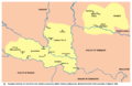
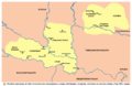
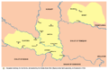
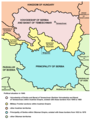
Media in category "Maps of the Habsburg period in the history of Serbia"
The following 96 files are in this category, out of 96 total.
-
 Bacs-Bodrog county map.jpg 1,697 × 2,125; 889 KB
-
 Das Koenigreich Serwien, 1791.jpg 603 × 438; 107 KB
-
 District of potisje en.png 578 × 1,127; 51 KB
-
 District of potisje sr.png 578 × 1,127; 50 KB
-
 District of velika kikinda en.png 627 × 1,044; 53 KB
-
 District of velika kikinda sr.png 627 × 1,044; 53 KB
-
 Eyalet of temesvar1699 hu.svg 1,347 × 1,312; 90 KB
-
 Eyalet of temesvar1699-sr.png 1,010 × 984; 101 KB
-
 Great serb migration-es.svg 8,584 × 7,087; 300 KB
-
 Great serb migration-pt.svg 8,584 × 7,087; 143 KB
-
 Great serb migration-sr.png 1,601 × 1,534; 123 KB
-
 Great serb migration.png 1,601 × 1,534; 150 KB
-
 Greater austria.png 1,500 × 1,280; 45 KB
-
 Vereinigte Staaten von Groß-Österreich.png 1,500 × 1,280; 192 KB
-
 대 오스트리아.png 1,500 × 1,280; 64 KB
-
 Greater austriaPL.png 1,500 × 1,280; 74 KB
-
 Habsburg Serbia.JPG 439 × 1,047; 101 KB
-
 Josephinische Landaufnahme Banat.jpg 1,446 × 1,778; 346 KB
-
 Josephinische Landaufnahme Slavonien.jpg 1,898 × 1,486; 213 KB
-
 Josephinische Landaufnahme Slavonischen Distrikt.jpg 2,749 × 1,831; 370 KB
-
 Kocina krajina.png 1,028 × 727; 88 KB
-
 Kocina krajina02.png 1,028 × 725; 95 KB
-
 KuK Nichtunierte.jpg 1,465 × 1,497; 1.29 MB
-
 Map of Central Europe in 1791 by Reilly 006.jpg 650 × 508; 104 KB
-
 Map of Central Europe in 1791 by Reilly 006b.jpg 1,200 × 906; 273 KB
-
 Militargrenze, Wojwodowena und Banat.jpg 900 × 312; 115 KB
-
 Wojwodowena und Banat.jpg 400 × 295; 42 KB
-
 Passarowitz 1718.JPG 1,200 × 1,681; 977 KB
-
 Patriarchate of Peć in the 16th and 17th century.png 1,170 × 1,383; 129 KB
-
 Pecka patrijarsija mapa sr.png 1,170 × 1,383; 123 KB
-
 Rascia in pannonia 16th 18th century-sr.png 1,356 × 716; 67 KB
-
 Rascia in pannonia 16th 18th century.png 1,356 × 716; 70 KB
-
 Regnorum Hungariae, Dalmatiae, Croatiae, Serviae et Principatus Transylvaniae, 1705.jpg 1,966 × 1,700; 4.8 MB
-
 Regnum Bosniae, una cum finitimis Croatiae, Damatiae, Slavoniae, Hung et Servia partibus.jpg 3,070 × 1,400; 5.31 MB
-
 Regnum Serviae, 1737.jpg 1,024 × 758; 327 KB
-
 Sabor u baji 1694 01.png 1,354 × 877; 74 KB
-
 Sabor u baji 1694 02.png 1,354 × 877; 76 KB
-
 Sabor u krusedolu 1708 01.png 1,354 × 877; 69 KB
-
 Sabor u krusedolu 1708 02.png 1,354 × 877; 69 KB
-
 Serbia religion 16th 17th 01.png 638 × 1,077; 61 KB
-
 Serbia religion 16th 17th 02.png 638 × 1,077; 62 KB
-
 Serbia1718 1739-sr.png 851 × 737; 73 KB
-
 Serbia1718 1739.png 851 × 737; 71 KB
-
 Serbia and Vojvodina 1848.png 717 × 924; 71 KB
-
 Serbia1849 04.png 724 × 949; 71 KB
-
 Serbia1849 sr latin.png 724 × 949; 72 KB
-
 Serbia02.png 724 × 949; 73 KB
-
 Serbia1849 01 01 04.png 724 × 760; 54 KB
-
 Serbia1849 01 02 02.png 724 × 760; 51 KB
-
 Serbia1849 01 03 03.png 724 × 760; 54 KB
-
 Serbia02 (Voivodina).png 724 × 760; 53 KB
-
 Voivodship and Serbia.png 724 × 949; 75 KB
-
 Vojvodina-1849-1860-2C.png 724 × 760; 60 KB
-
 Serbian Vojvodina and Tamis Banat ru.svg 793 × 423; 140 KB
-
 State of vojvodina 1906.png 1,023 × 1,081; 104 KB
-
 Szerb Vajdaság és Temesi Bánság.svg 793 × 423; 140 KB
-
 Szerem County Map.jpg 2,100 × 1,657; 383 KB
-
 Tamis banat1718 1739 hu.png 1,178 × 1,514; 423 KB
-
 Tamis banat1718 1739.png 1,008 × 1,298; 146 KB
-
 Tamis banat1718 1739 sr.png 1,008 × 1,298; 134 KB
-
 Banat03-sr.png 998 × 876; 85 KB
-
 Banat03.png 998 × 876; 102 KB
-
 Temeswarer Banat - Politische Situation 1739.png 998 × 876; 98 KB
-
 Tamis banat06-sr.png 996 × 988; 100 KB
-
 Tamis banat06.png 996 × 988; 111 KB
-
 Tamis banat1751 1778-sr.png 996 × 962; 98 KB
-
 Tamis banat1751 1778.png 996 × 962; 112 KB
-
 Temeswarer Banat - Politische Situation 1751 -1778.png 996 × 962; 108 KB
-
 Temes county map.jpg 1,650 × 2,115; 499 KB
-
 Temeswarer Banat.JPG 2,406 × 2,745; 1.69 MB
-
 Temisvarski sabor 1790 01.png 996 × 704; 84 KB
-
 Temisvarski sabor 1790 02.png 996 × 704; 69 KB
-
 Tican01.png 906 × 589; 58 KB
-
 Tican02.png 906 × 589; 59 KB
-
 Torontal county map.jpg 1,650 × 2,138; 513 KB
-
 Vojvodina front lines 1848 1849-sr.png 934 × 1,156; 108 KB
-
 Vojvodina front lines 1848 1849.png 934 × 1,227; 118 KB
-
 Map of Voivodeship of Serbia and Banat of Temeschwar (1849-1860).png 769 × 828; 95 KB
-
 Vojvodina map sr.png 769 × 828; 83 KB
-
 Vojvodina mapa.png 769 × 828; 79 KB
-
 Vojvodina XIX ru.svg 793 × 423; 135 KB
-
 Vojvodina03-sr.png 638 × 738; 67 KB
-
 Vojvodina03.png 638 × 737; 66 KB
-
 Vojvodina-1848-1.png 638 × 737; 69 KB
-
 Srpska Vojvodina 1848. i današnji ZVO.png 621 × 504; 23 KB
-
 Vojvodina10 hu.svg 1,035 × 948; 84 KB
-
 Vojvodina10-sr.png 1,035 × 948; 126 KB
-
 Vojvodina10.png 1,035 × 948; 133 KB
-
 Vojvodina10.svg 940 × 968; 111 KB
-
 Vojvodina18 19 cen-sr.png 2,000 × 1,563; 194 KB
-
 Vojvodina18 19 cen.png 2,000 × 1,563; 220 KB
-
 Vojvodschaft serbien 1853.jpg 800 × 563; 169 KB
-
 Vojvodstvo srbija okruzi 1849 01.png 769 × 746; 66 KB
-
 Vojvodstvo srbija okruzi 1849 02.png 769 × 746; 64 KB
-
 Vojvodstvo srbija okruzi 1850 01.png 769 × 828; 81 KB
-
 Vojvodstvo srbija okruzi 1850 02.png 769 × 828; 74 KB


.png)


.png)


