Category:Maps of the Gulf of Guinea
Jump to navigation
Jump to search
Subcategories
This category has only the following subcategory.
Media in category "Maps of the Gulf of Guinea"
The following 33 files are in this category, out of 33 total.
-

-
 Admiralty Chart No 1357 Cape Formosa to Fernando Po, Published 1841.jpg 8,083 × 6,061; 8.49 MB
-
 Admiralty Chart No 1357 River Benin to River Cameroons, Published 1895, New Edition 1930.jpg 16,440 × 11,345; 36.49 MB
-
 Bodleian Libraries, Gulf of Guinea 23.jpg 1,000 × 675; 138 KB
-
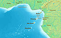
 Cameroon Nigeria border coast.jpg 580 × 575; 163 KB
-

-
 Carte de la commission du Golfe de Guinée.svg 1,000 × 1,000; 152 KB
-
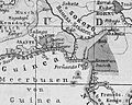
 Carte du golfe de Guinée-18e s..jpg 568 × 510; 67 KB
-
 Equatorialguineamap-ar.png 728 × 496; 259 KB
-
 Equatorialguineamap.png 728 × 496; 236 KB
-
 Golf of Guinea creoles.png 665 × 963; 7 KB
-
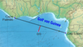
 Golf van Guinee.jpg 891 × 557; 78 KB
-
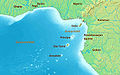
 Golf von Guinea um 1890.jpg 687 × 550; 329 KB
-
 Golf von Guinea.jpg 891 × 557; 53 KB
-
 Golf-Nullpunkz.png 723 × 407; 405 KB
-
 GUINEA ECUATORIAL.png 374 × 443; 269 KB
-
 Gulf of Guinea (blank).jpg 891 × 557; 136 KB
-
 Gulf of Guinea (English).jpg 891 × 557; 155 KB
-
 Gulf of Guinea (pl).jpg 891 × 557; 160 KB
-
 Gulf of Guinea es.png 835 × 522; 180 KB
-
 Gulf of Guinea fi.jpg 800 × 500; 93 KB
-
 Gulf of Guinea in its region.svg 500 × 281; 4.83 MB
-
 Gulf of Guinea ru.jpg 891 × 557; 164 KB
-
 Gulf of Guinea-fr.jpg 891 × 557; 164 KB
-
 Jineiya wan-zh-tw.png 891 × 557; 516 KB
-
 Jineiya wan-zh.jpg 891 × 557; 70 KB
-
 Jineiya wan-zh.png 891 × 557; 513 KB
-
 Karte Kamerun Küste 1887 B002a.png 2,090 × 3,392; 2.35 MB
-
 LaNature1873-245-LaCoteDOR-GuinéeSeptentrionale.png 1,090 × 404; 63 KB
-
 Limites du golfe de Guinée-fr.svg 1,188 × 1,781; 1.39 MB
-
 Map Cameroon Coast 1846 B002.png 1,860 × 2,998; 1.03 MB
-
 Europas Kolonien. 1 1885 (150828984).jpg 3,632 × 5,053; 9.56 MB
-
 НГБ Гвинейского залива.png 2,254 × 1,507; 471 KB
%27_(11180382453).jpg)


.jpg)


.jpg)
.jpg)


.jpg)

.jpg)