Category:Maps of the Free State
Jump to navigation
Jump to search
Provinces of South Africa: Eastern Cape · Free State · Gauteng · KwaZulu-Natal · Limpopo · Mpumalanga · Northern Cape · North West · Western Cape
Subcategories
This category has the following 5 subcategories, out of 5 total.
Media in category "Maps of the Free State"
The following 29 files are in this category, out of 29 total.
-
 10 of 'History of the Boers in South Africa ... with three maps' (11189449154).jpg 1,457 × 2,254; 586 KB
-
 LINDLEY(1873) Adamantia p041.jpg 3,083 × 2,421; 3.09 MB
-
 275 of 'History of the Boers in South Africa ... with three maps' (11189780013).jpg 2,150 × 1,406; 577 KB
-
 Blank map of the Free State (2006).svg 749 × 667; 1.74 MB
-
 Blank map of the Free State (2011).svg 749 × 667; 461 KB
-
 Blank map of the Free State (2016).svg 749 × 667; 613 KB
-
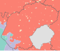
 Free State 2001 dominant language map.svg 1,095 × 913; 1.44 MB
-
 Free State 2001 dominant population group map.svg 1,095 × 913; 1.14 MB
-
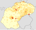
 Free State 2001 population density map.svg 1,095 × 913; 2.24 MB
-
 Free State 2011 population density map.svg 1,095 × 913; 554 KB
-
 Kartaboerkriget.jpg 1,000 × 884; 58 KB
-
 Map of the Free State with municipalities blank (2006).svg 828 × 693; 1.66 MB
-
 Oktober 2020 veldbrande in die Wes-Vrystaat, Suid-Afrika.png 627 × 556; 134 KB
-
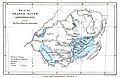
 Orange Free State Districts.png 1,000 × 876; 53 KB
-
 South Africa Free State location map.svg 1,130 × 1,008; 286 KB
-
 South Africa Free State relief location map.svg 1,130 × 1,008; 2.24 MB
-
 Spion Kop Farm fauna.jpg 926 × 756; 111 KB
-

-
 Welkom location in Free State.gif 470 × 402; 37 KB
-
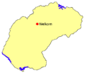 Welkom location in Free State.png 470 × 402; 12 KB
-
 ZA Free State language.gif 943 × 667; 115 KB
-
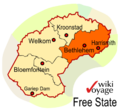 ZA-FS-eastern.png 399 × 374; 54 KB
-
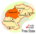 ZA-FS-goldf.png 399 × 374; 54 KB
-
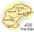
 ZA-FS-map.png 399 × 374; 55 KB
-
 ZA-FS-map.svg 400 × 375; 53 KB
-
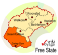
 ZA-FS-motheo.png 399 × 374; 55 KB
-
 ZA-FS-northern.png 399 × 374; 54 KB
-
 ZA-FS-xariep.png 399 × 374; 53 KB
-

.jpg)
_Adamantia_p041.jpg)
.jpg)


.jpg)


.jpg)
.svg)
.svg)
.svg)
.svg)