Category:Maps of the Franciscan Cadaster of Moravia
Jump to navigation
Jump to search
Čeština: Katastrální mapy Moravy v měřítku 1:2880 pořizované v rámci Stabilního katastru (Franziszeische Kataster) ve 20. až 40. letech 19. století na základě patentu císaře Františka I. z 23. prosince 1817.
Subcategories
This category has the following 2 subcategories, out of 2 total.
B
Media in category "Maps of the Franciscan Cadaster of Moravia"
The following 24 files are in this category, out of 24 total.
-
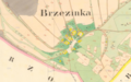 Březinka 1835.png 1,371 × 852; 1.35 MB
-
 Doubrava SK 1836.jpg 3,000 × 2,000; 2.16 MB
-
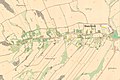
 Dukovany lipnany stabil 1825.jpg 1,143 × 852; 151 KB
-
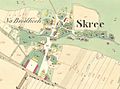 Dukovany skreje stabil 1825.jpg 1,286 × 958; 244 KB
-
 Dvorek Oslavany.jpg 829 × 831; 242 KB
-
 Hradcovice cadastral map 1827.jpg 3,000 × 4,000; 5.3 MB
-
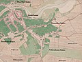
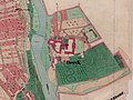 Kloster Bruck (Edelspitz) OMSK 1845.jpg 4,000 × 3,000; 6.53 MB
-
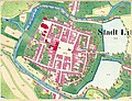 Litovel, mapa, 1834.jpg 3,669 × 2,818; 2.49 MB
-
 Morkovice 1827.jpg 774 × 869; 923 KB
-
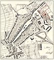
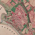
 Ollmütz COSK 1833-centrum.jpg 4,000 × 3,373; 4.17 MB
-
 Ollmütz COSK 1833.jpg 4,000 × 4,140; 3.73 MB
-
 Palačov Historická mapa.jpg 1,388 × 899; 888 KB
-
 Palačov Mlýnská strouha.png 1,804 × 770; 3.21 MB
-
 Palačovská Keř.png 1,064 × 858; 1.46 MB
-
 Prerau OMSK 1830 detail.jpg 3,000 × 3,000; 5.14 MB
-
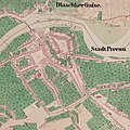
 Prerau OMSK 1830.jpg 3,000 × 2,250; 3.88 MB
-

-
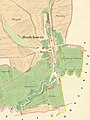
 Rouchovany hermanice stabil 1825.jpg 938 × 582; 182 KB
-
 Slavkov SK 1826 centrum (02).jpg 4,000 × 2,443; 3.88 MB
-
 Slavkov SK 1826 centrum (03).jpg 4,000 × 2,000; 2.71 MB
-
 Slavkov SK 1826 centrum.jpg 4,000 × 4,000; 5.51 MB
-
 Zaniklá ves Čeladice.jpg 642 × 596; 251 KB
-
 Znaim OMSK 1845 detail.jpg 3,000 × 3,000; 6.02 MB
-
 Znaim OMSK 1845.jpg 3,000 × 2,250; 4.62 MB


_OMSK_1845.jpg)


.jpg)
.jpg)


