Category:Maps of the Federal Republic of Central America
Jump to navigation
Jump to search
Subcategories
This category has the following 2 subcategories, out of 2 total.
Media in category "Maps of the Federal Republic of Central America"
The following 21 files are in this category, out of 21 total.
-
 Carte de la Republique de L'Amerique Centrale.jpg 2,576 × 1,690; 1.46 MB
-
 Confederazione Guatimala o Stati Uniti nell' America-Centrale.jpg 2,056 × 2,904; 1.06 MB
-
 Departamentos El Salvador 1824.svg 1,395 × 884; 31 KB
-
 Distritos El Salvador 1824.svg 1,993 × 1,109; 53 KB
-
 Federal Republic of Central America (orthographic projection).svg 550 × 550; 86 KB
-
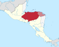 Federal Republic of Central America location map (Honduras and the Mosquito Coast).svg 2,400 × 1,900; 1.24 MB
-
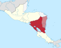 Federal Republic of Central America location map (Nicaragua and the Mosquito Coast).svg 2,400 × 1,900; 1.24 MB
-
 Federal Republic of Central America location map.svg 2,400 × 1,900; 1.24 MB
-
 Locatie Centraal Amerika.png 250 × 115; 5 KB
-
 LocationWHFederalRepublicofCentralAmerica.png 800 × 800; 32 KB
-
 Mexico's Territorial Evolution.png 1,669 × 1,518; 113 KB
-
 Provincias Unidas de Centroamérica 1823.png 1,290 × 1,123; 219 KB
-
 Provincias Unidas de Centroamérica 1823.svg 1,209 × 1,053; 116 KB
-
 Republica Federal de Centroamerica 1826.png 1,290 × 1,123; 205 KB
-
 Republica Federal de Centroamerica 1836.png 1,290 × 1,123; 212 KB
-
 Republica Federal de Centroamerica 1838.png 1,290 × 1,123; 234 KB
-
 Ubicación Provincias Unidas del Centro de América.png 250 × 115; 5 KB
-
 United Provinces of Central America (orthographic projection).svg 550 × 550; 199 KB
-
 Lizars Mexico & Guatimala 1831 UTA.jpg 6,185 × 5,238; 11.59 MB
-
 Lizars Mexico & Guatimala 1836 UTA (cropped).jpg 6,247 × 5,049; 16.37 MB
-
 Lizars Mexico & Guatimala 1836 UTA.jpg 6,566 × 5,320; 14 MB


.svg)
.svg)
.svg)


.svg)

.jpg)
