Category:Maps of the Cold War
Jump to navigation
Jump to search
Subcategories
This category has the following 13 subcategories, out of 13 total.
A
C
- Maps of the Cambodian Civil War (13 F)
I
- Maps of the Iran-Iraq War (35 F)
L
- Maps of the Laotian Civil War (23 F)
M
- Maps of the Cold War in Europe (129 F)
- Maps of Warsaw Pact (25 F)
S
U
V
W
- World maps of the Cold War (46 F)
Media in category "Maps of the Cold War"
The following 66 files are in this category, out of 66 total.
-
 1945 Alemaniaren lehen banaketa II. Mundu Gerra amaitu ondoren.jpg 2,008 × 2,835; 842 KB
-
 1945 Russian and Manchurian Strategic Urban Areas.jpg 3,972 × 2,941; 1.27 MB
-
 1950-1953 Koreako Gerra.jpg 2,008 × 2,835; 706 KB
-
 1961 anti-Soviet Union propaganda map - Concept of Deterrence.jpg 18,421 × 14,336; 40.4 MB
-
 The Third World – Cockpit of Conflict, Soviet Global Power Projection.png 1,203 × 881; 184 KB
-
 AfricaColdWar.png 585 × 600; 55 KB
-
 Asian rimland, 1950.jpg 1,029 × 1,349; 250 KB
-
 AtomWeaponVW.jpg 1,132 × 982; 163 KB
-
 August 1945 Coverage of USSR by B-29s and B-36s.jpg 1,297 × 1,518; 556 KB
-
 Bamboo Curtain.PNG 300 × 213; 6 KB
-
 Changes in borders post cold war.PNG 588 × 464; 17 KB
-
 CheGuevaraCountries.jpg 1,357 × 690; 147 KB
-
 Chevaline patrol limits-corrected.png 447 × 424; 10 KB
-
 Chrome Dome 1961.jpg 2,882 × 1,949; 3.92 MB
-
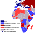 Cold War Africa 1980.PNG 458 × 437; 18 KB
-
 Cold War WorldMap 1962.png 1,405 × 703; 64 KB
-
 Cold-war-47-55-s.svg 1,000 × 450; 858 KB
-
 Coldwar.svg 384 × 387; 1,003 KB
-
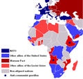 Cold–War Africa 1980.PNG 458 × 437; 18 KB
-
 Communist Block.svg 940 × 477; 1.86 MB
-
 Communist Contagion (cropped).jpg 2,879 × 1,179; 1.33 MB
-
 Continental Defense Warning Systems.png 1,260 × 789; 727 KB
-
 Course followed by USS Triton in 1960.png 834 × 918; 862 KB
-
 Deployment of USAF combat forces CONUS as of July 1, 1960.png 830 × 595; 259 KB
-
 Deployment of USAF combat forces worldwide as of July 1, 1960.png 849 × 584; 547 KB
-
 Dew line 1960.jpg 962 × 996; 196 KB
-
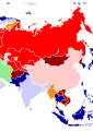 Division de Asia por bandos en la Guerra Fría.svg 8,268 × 11,692; 616 KB
-
 English Electric Canberra and Martin B-57 Canberra operators.png 1,425 × 625; 30 KB
-
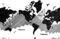
 First second third worlds map.svg 860 × 440; 1.36 MB
-
 GIUK gap.png 1,024 × 1,239; 769 KB
-
 Guerra Fria alianças em 1947-1953.png 1,405 × 703; 58 KB
-
 Guik gap.gif 1,024 × 1,239; 465 KB
-
 Guèrra de Vietnam (1965).png 737 × 640; 117 KB
-
 Hoang Sa3.PNG 642 × 442; 72 KB
-
-
 Hub of Asia, 1955.jpg 1,060 × 1,470; 316 KB
-
 INF-FacilitiesUSSR.jpg 3,162 × 2,488; 856 KB
-
 Influence russia in europe.PNG 604 × 202; 7 KB
-

-
 Map of Marxist–Leninist states.png 1,425 × 625; 36 KB
-
 Mapa Pakistanu Zachodniego PL.gif 700 × 600; 13 KB
-
 Modified Phase II Safeguard defense (FY 71 recomendation).png 972 × 742; 588 KB
-
 Molotov plan 1947.png 596 × 219; 9 KB
-
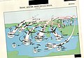
 North Radar System.png 2,168 × 1,699; 1.59 MB
-
 Operation Chrome Dome.png 1,174 × 611; 106 KB
-

-
 Premiera Guèrra d'Afganistan.png 692 × 448; 85 KB
-

-

-

-

-
-

-
 Soviet naval threat to the Trident-armed submarine fleet.png 1,200 × 752; 747 KB
-

-

-
-
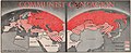
 The growth of Russian Imperialism, 1961.jpg 1,900 × 1,139; 937 KB
-
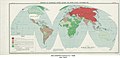
 The Soviet Union and all of its states.png 6,460 × 3,403; 1,005 KB
-
 Trident Pacific area of operations from Bangor naval base.png 1,250 × 971; 790 KB
-
 Trident patrol area 1975 and beyond.png 1,372 × 895; 732 KB
-
 U2 GrandSlam-ru.png 941 × 630; 353 KB
-
 US fallout exposure.png 615 × 432; 119 KB
-
 United States collective security arrangements by 1960.png 1,424 × 808; 1.24 MB
-
 US Civil Defense Regional Boundaries and Field Installations.png 1,024 × 808; 515 KB
-
 West Pakistan Map.gif 700 × 600; 13 KB


.png)


.png)


.jpg)